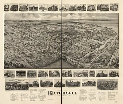
Pearl River, New York, 1924 – Historic Map Reproduction

(Originally scanned by the Library of Congress. Each image is professionally and digitally cleaned of artifacts such as color bars and extra borders prior to printing.)
Description
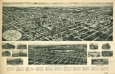
This antique map of Pearl River, New York, 1924 brings a moment of history to your wall. The original is held by the Library of Congress, so what you hang is a true record of its time.
Library of Congress record: Aero-view of Pearl River, New York, 1924
The framed print arrives ready to hang; the unframed option suits custom framing. A fine choice for anyone who loves history, and a gift that gets noticed. Free shipping in the lower 48 states. Snapshots of the Past, founded in 2001, has served tens of thousands of customers worldwide.
Pearl River, New York, 1924
Order a print
Thank you. Your order went through, and a receipt is on its way by email.
Secure checkout · SSL encryptedPowered by Stripe and PayPal
Free shipping in the lower 48 states. The checkout page shows the picture, size and price before you pay.
Pearl River, New York, in 1924 was a small hamlet in the town of Orangetown in Rockland County, on the west shore of the Hudson and a short ride from New York City. The Erie Railroad's main line ran through the community, and its Piermont branch carried freight and passengers toward the river, so rail access shaped how the place grew. Farming, orchards, and small local manufacturing still counted for much of the local economy, though the steady flow of commuters and daytime visitors from the city was already changing the area. Residents of the day would have known Pearl River mainly as a quiet railroad stop and a gateway to the surrounding Rockland County countryside, where roads were improving but many families still depended on the train.
| Created / published | 1924 |
|---|---|
| Creator | hughes & bailey, cinquin, rene |
| Notes | Bird's-eye view map. |
| Subjects | Panoramic maps--New York |
| Source | Library of Congress, Panoramic Maps |
| Original scan | 10,320 × 6,160 px · prints to 34 × 21 in at 300 dpi |
| Library of Congress title | Aero-view of Pearl River, New York, 1924 |
| Reference | NY PearlRiver 1924 |
More from the Panoramic Maps collection
Snapshots of the Past helps heritage brands, museums, historians and storytellers tell stories with history: historic prints, image licensing and historical storytelling drawn from more than 25 years of research and curation.