MI Grand Haven 1868 MAP – Historic Map Reproduction

(Originally scanned by the Library of Congress. Each image is professionally and digitally cleaned of artifacts such as color bars and extra borders prior to printing.)
Description
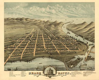
Few images capture their era like this antique map of MI Grand Haven 1868 MAP. It comes from the collections of the Library of Congress, scanned from the original and carefully restored.
Library of Congress record: Birds eye view of the city of Grand Haven, Ottawa Co., Michigan 1868
Choose the framed print, ready to hang the day it arrives, or the unframed print for a frame of your own. A conversation-starting piece for home, office, or as a meaningful gift. Free shipping in the lower 48 states. Snapshots of the Past has been bringing history to the wall since 2001, for tens of thousands of customers worldwide.
MI Grand Haven 1868 MAP
Order a print
Thank you. Your order went through, and a receipt is on its way by email.
Secure checkout · SSL encryptedPowered by Stripe and PayPal
Free shipping in the lower 48 states. The checkout page shows the picture, size and price before you pay.
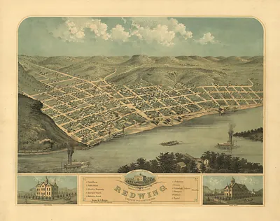
Where the Grand River meets Lake Michigan, Grand Haven is shown here as a bird's-eye panorama, with the river mouth and harbor in the foreground. In 1868 the town was a busy port for the lumber trade, and the waterfront and piers in the view reflect the shipping that moved timber cut in the surrounding region. Albert Ruger, a draftsman who made many city views for Midwestern towns in the 1860s and 1870s, drew the scene for the Merchant's Lithographing Company. Maps like this were often sold to residents and local businesses as a record of a town's growth.
| Created / published | 1868 |
|---|---|
| Creator | ruger, a., merchant's lithographing company, glover, e. s. (eli sheldon) |
| Source | Library of Congress, Panoramic Maps |
| Original scan | 4,347 × 3,441 px · prints to 14 × 11 in at 300 dpi |
| Library of Congress title | Birds eye view of the city of Grand Haven, Ottawa Co., Michigan 1868 |
| Reference | MI-GrandHaven-1868 |
More from the PAN MAPS collection
Snapshots of the Past helps heritage brands, museums, historians and storytellers tell stories with history: historic prints, image licensing and historical storytelling drawn from more than 25 years of research and curation.