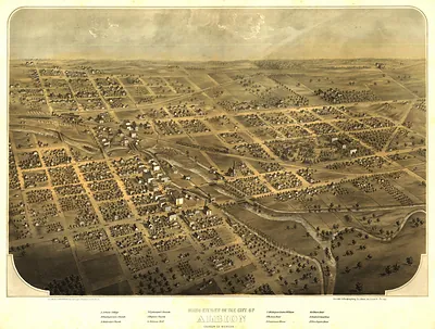
MN Red Wing 1868 MAP – Historic Map Reproduction

(Originally scanned by the Library of Congress. Each image is professionally and digitally cleaned of artifacts such as color bars and extra borders prior to printing.)
Description
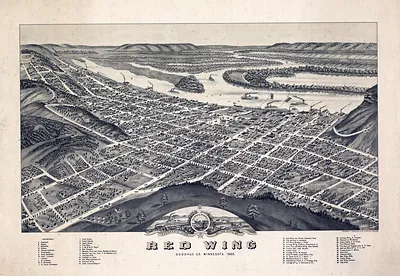
MN Red Wing 1868 MAP comes to life in this antique map, reproduced from the original with every detail intact. The original is held by the Library of Congress, so what you hang is a true record of its time.
Library of Congress record: Bird's eye view of the city of Redwing, Coodhue [sic] Co., Minnesota 1868
Order it framed and ready to hang, or unframed to match a frame you already love. A fine choice for anyone who loves history, and a gift that gets noticed. Free shipping in the lower 48 states. Snapshots of the Past, founded in 2001, has served tens of thousands of customers worldwide.
MN Red Wing 1868 MAP
Order a print
Thank you. Your order went through, and a receipt is on its way by email.
Secure checkout · SSL encryptedPowered by Stripe and PayPal
Free shipping in the lower 48 states. The checkout page shows the picture, size and price before you pay.
This bird's-eye view shows Red Wing, a river town on the Mississippi in Goodhue County, Minnesota, as it looked in 1868, just a few years after it had grown into a busy landing for steamboats and grain shipments. Panoramic maps like this one were drawn from an imagined high vantage point, so streets, church spires, warehouses and houses appear in tilted perspective, and each building was often rendered to show its real character. The map was issued by Robert Teufel & Co., with the artist credited as A. Ruger, a well-known maker of town views in the Midwest. Such maps were sold to local residents and businesses as a point of civic pride, and today they serve as a detailed record of how a frontier river town was laid out.
| Created / published | 1868 |
|---|---|
| Creator | robert teufel & co, ruger, a. |
| Source | Library of Congress, Panoramic Maps |
| Original scan | 4,064 × 3,216 px · prints to 14 × 11 in at 300 dpi |
| Library of Congress title | Bird's eye view of the city of Redwing, Coodhue [sic] Co., Minnesota 1868 |
| Reference | MN-Redwing-1868 |
More from the PAN MAPS collection
Snapshots of the Past helps heritage brands, museums, historians and storytellers tell stories with history: historic prints, image licensing and historical storytelling drawn from more than 25 years of research and curation.