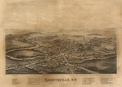
De Ruyter, New York, 1892 – Antique Wall Map

(Originally scanned by the Library of Congress. Each image is professionally and digitally cleaned of artifacts such as color bars and extra borders prior to printing.)
Description
This rare antique map captures De Ruyter, New York, 1892 in remarkable detail. An authentic image from the Library of Congress, it carries the weight of the real historical record.
Library of Congress record: De Ruyter, N.Y.
Framed, it is ready for the wall; unframed, it is ready for the frame you choose. It brings character to any room and makes a memorable gift. Free shipping in the lower 48 states. Snapshots of the Past, founded in 2001, has served tens of thousands of customers worldwide.
De Ruyter, New York, 1892
Order a print
Thank you. Your order went through, and a receipt is on its way by email.
Secure checkout · SSL encryptedPowered by Stripe and PayPal
Free shipping in the lower 48 states. The checkout page shows the picture, size and price before you pay.
De Ruyter, a village in Madison County in central New York, took its name from Michiel de Ruyter, the 17th-century Dutch admiral, and in 1892 it was a small rural community whose livelihood came from the land around it. Farming and dairying drove the local economy, as they did across the hills and valleys of the Chenango and Oneida region, with milk, cheese, and grain moving to larger markets by wagon and rail. Villagers depended on churches, schools, and the local stores and mills that served the surrounding farms, and the seasonal rhythms of planting, haying, and harvest set the pace of daily life. A bird's-eye view like this one would have shown residents their own streets, homes, and fields laid out together, a record of a settlement that was modest in size but tied closely to the agricultural life of the county.
| Created / published | 1892 |
|---|---|
| Creator | burleigh litho |
| Notes | Bird's-eye view map. |
| Subjects | Panoramic maps--New York |
| Source | Library of Congress, Panoramic Maps |
| Original scan | 7,216 × 4,800 px · prints to 24 × 16 in at 300 dpi |
| Library of Congress title | De Ruyter, N.Y. |
| Reference | NY DeRuyter 1892 |
More from the Panoramic Maps collection
Snapshots of the Past helps heritage brands, museums, historians and storytellers tell stories with history: historic prints, image licensing and historical storytelling drawn from more than 25 years of research and curation.