Jefferson, Ohio – Vintage Wall Art

(Each image is professionally and digitally cleaned of artifacts such as color bars and extra borders prior to printing.)
Description
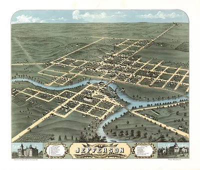
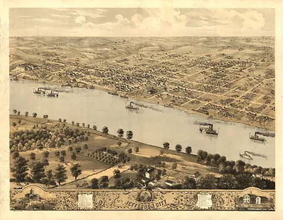
Few images capture their era like this antique map of Jefferson, Ohio. It is part of the Snapshots of the Past archive, gathered over 25 years of research.
Choose the framed print, ready to hang the day it arrives, or the unframed print for a frame of your own. A conversation-starting piece for home, office, or as a meaningful gift. Free shipping in the lower 48 states. Snapshots of the Past, founded in 2001, has served tens of thousands of customers worldwide.
Jefferson, Ohio
Order a print
Thank you. Your order went through, and a receipt is on its way by email.
Secure checkout · SSL encryptedPowered by Stripe and PayPal
Free shipping in the lower 48 states. The checkout page shows the picture, size and price before you pay.
Jefferson is the county seat of Ashtabula County in northeastern Ohio, and this record credits T. M. Fowler of Morrisville, Pennsylvania, as the drawer. Around 1901, pictorial maps like this one typically showed a town from an angled, elevated viewpoint, with streets, houses and public buildings drawn in recognizable detail. Such views served civic boosterism as much as navigation, presenting a community's growth and pride to residents and visitors. Worth noticing is how these drawings combined a surveyor's street grid with the look of a painting.
| Created / published | c. 1901 |
|---|---|
| Medium | map 29 x 56 cm. |
| Notes | Drawn by T. M. Fowler. Morrisville, Pa |
| Original scan | 3,750 × 2,352 px · prints to 12 × 8 in at 300 dpi |
| Reference | pm006940 Jefferson, Ohio 1901. |
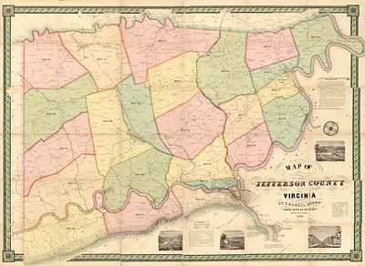
More from the Jefferson collection
Snapshots of the Past helps heritage brands, museums, historians and storytellers tell stories with history: historic prints, image licensing and historical storytelling drawn from more than 25 years of research and curation.