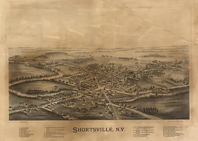
Albany, New York, 1879 – Antique Map Print

(Originally scanned by the Library of Congress. Each image is professionally and digitally cleaned of artifacts such as color bars and extra borders prior to printing.)
Description
A window into the past: Albany, New York, 1879, preserved in this antique map. The original is held by the Library of Congress, so what you hang is a true record of its time.
Library of Congress record: Albany, New York 1879
Framed, it is ready for the wall; unframed, it is ready for the frame you choose. Perfect for a home, office, library or classroom wall, and a gift with a story behind it. Free shipping in the lower 48 states. Snapshots of the Past has been bringing history to the wall since 2001, for tens of thousands of customers worldwide.
Albany, New York, 1879
Order a print
Thank you. Your order went through, and a receipt is on its way by email.
Secure checkout · SSL encryptedPowered by Stripe and PayPal
Free shipping in the lower 48 states. The checkout page shows the picture, size and price before you pay.
Albany, New York, in 1879 was the state capital and a Hudson River city of roughly 90,000 people, with the Erie Canal's eastern terminus at its waterfront. Its economy rested on heavy manufacturing, especially iron foundries and the stove works for which the city was widely known, while breweries and river shipping kept the docks busy. Railroads, including the New York Central line running along the river, tied the city to New York City and the West, and the State Capitol was still rising in its long construction on the hill above downtown. Residents knew Albany as the seat of state government and the commercial center of the upper Hudson valley, where legislators, merchants, and mill hands shared the same crowded streets.
| Created / published | 1879 |
|---|---|
| Creator | beck & pauli, h.h. rowley & co |
| Notes | Bird's-eye view map. |
| Subjects | Panoramic maps--New York |
| Source | Library of Congress, Panoramic Maps |
| Original scan | 13,771 × 9,360 px · prints to 46 × 31 in at 300 dpi |
| Library of Congress title | Albany, New York 1879 |
| Reference | NY Albany 1879 |
More from the Panoramic Maps collection
Snapshots of the Past helps heritage brands, museums, historians and storytellers tell stories with history: historic prints, image licensing and historical storytelling drawn from more than 25 years of research and curation.