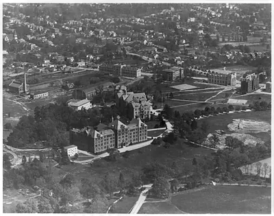
Aerial view of Dulles International Airport – Vintage Wall Art

(Originally scanned by the Library of Congress. Each image is professionally and digitally cleaned of artifacts such as color bars and extra borders prior to printing.)
Description
This historic photograph of Aerial view of Dulles International Airport brings a moment of history to your wall. It comes from the collections of the Library of Congress, scanned from the original and carefully restored.
Order it framed and ready to hang, or unframed to match a frame you already love. It makes a striking addition to a living room, study or office, and a thoughtful gift. Free shipping in the lower 48 states. Snapshots of the Past has been bringing history to the wall since 2001, for tens of thousands of customers worldwide.
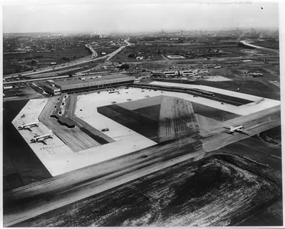
Aerial view of Dulles International Airport
Order a print
Thank you. Your order went through, and a receipt is on its way by email.
Secure checkout · SSL encryptedPowered by Stripe and PayPal
Free shipping in the lower 48 states. The checkout page shows the picture, size and price before you pay.
Few airports of the early jet age were designed to be appreciated from above, and Dulles International, which opened west of Washington, D.C., in 1962, was one of them. Its main terminal, designed by Eero Saarinen, sweeps out under a long, low concrete roof, and an aerial view like this one shows the building set among open fields with runways stretching away from it. The Federal Aviation Agency, which oversaw civil aviation at the time, produced this print, but the date of about 1965 is an estimate drawn from an old caption card. Pictures like it recorded how the new airport took its place in the growing Washington region.
| Created / published | [1965?] |
|---|---|
| Medium | 1 photographic print. |
| Subjects | Photoprint by Federal Aviation Agency. This record contains unverified, old data from caption card. Caption card tracings: Va.--?; Wash., DC--Dulles...; Airports--Wash. metrop.; Aerial photos--Va.--?; Shelf. |
| Source | Library of Congress, Prints and Photographs Division |
| Original scan | 1,536 × 1,038 px · prints to 5 × 3 in at 300 dpi |
| Reference | AMZ-SOTP-HPA-137056 |
More from the Historic Print Archive collection
Snapshots of the Past helps heritage brands, museums, historians and storytellers tell stories with history: historic prints, image licensing and historical storytelling drawn from more than 25 years of research and curation.