Brooklyn Bridge, New York, 1895 – Vintage Map Wall Art

(Originally scanned by the Library of Congress. Each image is professionally and digitally cleaned of artifacts such as color bars and extra borders prior to printing.)
Description
This antique map of Brooklyn Bridge, New York, 1895 brings a moment of history to your wall. Sourced directly from the Library of Congress, it represents an authentic piece of documented history.
Library of Congress record: Grand birds eye view of the Great East River Suspension Bridge. Connecting the cities of New York & Brooklyn showing also the splendid panorama of the bay and part of New York
Choose the framed print, ready to hang the day it arrives, or the unframed print for a frame of your own. It brings character to any room and makes a memorable gift. Free shipping in the lower 48 states. Snapshots of the Past, founded in 2001, has served tens of thousands of customers worldwide.
Brooklyn Bridge, New York, 1895
Order a print
Thank you. Your order went through, and a receipt is on its way by email.
Secure checkout · SSL encryptedPowered by Stripe and PayPal
Free shipping in the lower 48 states. The checkout page shows the picture, size and price before you pay.
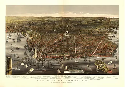
In 1895 the Brooklyn Bridge was twelve years old, and it still stood as the most visible link between Manhattan and Brooklyn, which remained a separate city until it merged into Greater New York in 1898. The East River below carried a dense traffic of ferries, lighters, and steamships serving the docks, sugar refineries, and the Navy Yard on the Brooklyn side. Residents on both shores crossed the span on foot, by horsecar, and by cable car to reach jobs, markets, and the rapidly growing outer neighborhoods. Its granite towers and steel cables were a point of civic pride, and many New Yorkers still recalled the 1883 opening as a turning point for the region.
| Created / published | 1895 |
|---|---|
| Creator | currier & ives |
| Notes | Bird's-eye view map. |
| Subjects | Panoramic maps--New York |
| Source | Library of Congress, Panoramic Maps |
| Original scan | 11,577 × 8,096 px · prints to 39 × 27 in at 300 dpi |
| Library of Congress title | Grand birds eye view of the Great East River Suspension Bridge. Connecting the cities of New York & Brooklyn showing also the splendid panorama of the bay and part of New York |
| Reference | NY Brooklyn Bridge 1895 |
More from the Panoramic Maps collection
Snapshots of the Past helps heritage brands, museums, historians and storytellers tell stories with history: historic prints, image licensing and historical storytelling drawn from more than 25 years of research and curation.