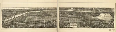
New York City Brooklyn, New York, 1851 – Historic Map Reproduction

(Originally scanned by the Library of Congress. Each image is professionally and digitally cleaned of artifacts such as color bars and extra borders prior to printing.)
Description
Step back in time with New York City Brooklyn, New York, 1851, an antique map rich in period detail. An authentic image from the Library of Congress, it carries the weight of the real historical record.
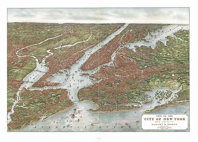
Library of Congress record: Bird's eye view of New-York & Brooklyn
The framed print arrives ready to hang; the unframed option suits custom framing. A fine choice for anyone who loves history, and a gift that gets noticed. Free shipping in the lower 48 states. Snapshots of the Past has been bringing history to the wall since 2001, for tens of thousands of customers worldwide.
New York City Brooklyn, New York, 1851
Order a print
Thank you. Your order went through, and a receipt is on its way by email.
Secure checkout · SSL encryptedPowered by Stripe and PayPal
Free shipping in the lower 48 states. The checkout page shows the picture, size and price before you pay.
New York City and Brooklyn in 1851 were on the verge of enormous change. Brooklyn had been incorporated as a city in 1834 and was a separate municipality across the East River, growing fast as a residential and manufacturing community tied to Manhattan by ferries. Manhattan's population had passed 500,000 by 1850, and the city's economy rested on its port, its shipping lines, and a growing mix of foundries, sugar refineries, and garment and printing trades. Brooklyn's shipyards and rope walks served the same maritime trade, and the Atlantic Dock Company was building facilities on the Brooklyn waterfront at this time. Residents of both sides of the river would have known the view as a city of masts, ferries, and expanding streets, months before the Brooklyn Bridge was ever proposed.
| Created / published | 1851 |
|---|---|
| Creator | bachmann, john |
| Notes | Bird's-eye view map. |
| Subjects | Panoramic maps--New York |
| Source | Library of Congress, Panoramic Maps |
| Original scan | 5,248 × 3,944 px · prints to 17 × 13 in at 300 dpi |
| Library of Congress title | Bird's eye view of New-York & Brooklyn |
| Reference | NY New York City Brooklyn 1851 |
More from the Panoramic Maps collection
Snapshots of the Past helps heritage brands, museums, historians and storytellers tell stories with history: historic prints, image licensing and historical storytelling drawn from more than 25 years of research and curation.