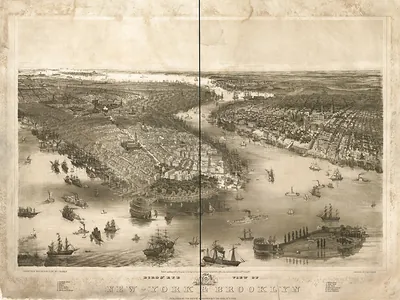
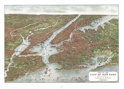
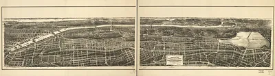
New York City Map of Bay and Harbor, New York, 1845 – Historic Map Reproduction

(Each image is professionally and digitally cleaned of artifacts such as color bars and extra borders prior to printing.)
Description
This antique map of New York City Map of Bay and Harbor, New York, 1845 brings a moment of history to your wall. It is part of the Snapshots of the Past archive, gathered over 25 years of research.
Framed, it is ready for the wall; unframed, it is ready for the frame you choose. A fine choice for anyone who loves history, and a gift that gets noticed. Free shipping in the lower 48 states. Snapshots of the Past, founded in 2001, has served tens of thousands of customers worldwide.
New York City Map of Bay and Harbor, New York, 1845
Order a print
Thank you. Your order went through, and a receipt is on its way by email.
Secure checkout · SSL encryptedPowered by Stripe and PayPal
Free shipping in the lower 48 states. The checkout page shows the picture, size and price before you pay.
In 1845, New York City was the largest port in the United States, and its harbor was crowded with sailing ships, steamboats, and ferries moving goods along the Hudson, the East River, and the coastal trade. The Erie Canal, finished in 1825, had made the city the main outlet for western grain, flour, and produce, and its merchants, shipbuilders, and warehouse owners depended on the waterfront. Brooklyn, across the East River, was still a separate city, and the growing population of the island was pressing north into farmland and village roads. The Croton Aqueduct, completed in 1842, had recently brought fresh water into the city, a civic improvement residents were proud of. Later that same year, the Great Fire of December 1845 would burn much of the lower Manhattan business district.
| Created / published | 1845 |
|---|---|
| Notes | Bird's-eye view map. |
| Subjects | Panoramic maps--New York |
| Original scan | 10,583 × 7,546 px · prints to 35 × 25 in at 300 dpi |
| Reference | NY New York City Map of Bay and Harbor 1845 |
More from the Panoramic Maps collection
Snapshots of the Past helps heritage brands, museums, historians and storytellers tell stories with history: historic prints, image licensing and historical storytelling drawn from more than 25 years of research and curation.