CANADA-Brantford-1875 – Vintage Map Wall Art

(Originally scanned by the Library of Congress. Each image is professionally and digitally cleaned of artifacts such as color bars and extra borders prior to printing.)
Description
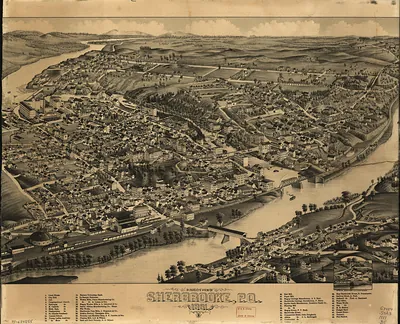
Few images capture their era like this antique map of CANADA-Brantford-1875. The original is held by the Library of Congress, so what you hang is a true record of its time.
Library of Congress record: Bird's eye view of Brantford, province Ontario, Canada 1875
Order it framed and ready to hang, or unframed to match a frame you already love. It makes a striking addition to a living room, study or office, and a thoughtful gift. Free shipping in the lower 48 states. Since 2001, Snapshots of the Past has shipped historic prints to tens of thousands of customers around the world.
CANADA-Brantford-1875
Order a print
Thank you. Your order went through, and a receipt is on its way by email.
Secure checkout · SSL encryptedPowered by Stripe and PayPal
Free shipping in the lower 48 states. The checkout page shows the picture, size and price before you pay.
Brantford, Ontario, sat on the Grand River in 1875, a manufacturing town of several thousand people whose mills and foundries drew on the river's waterpower. The Grand Trunk Railway's line through the town tied its factories and farm trade to Toronto, Hamilton, and Montreal, and the town's agricultural implement makers shipped goods across Ontario and beyond. The economic slump that followed the Panic of 1873 weighed on local employers and workers alike, even as merchants and civic leaders pressed for new streets, schools, and churches. Just outside town, the Six Nations of the Grand River reserve, home to Haudenosaunee communities who had settled there after the American Revolution, shaped the region's politics and daily life. Alexander Graham Bell's family lived on the heights above the river, and in 1875 he was working on his telephone experiments nearby, though few residents yet guessed what that work would mean.
| Created / published | 1875 |
|---|---|
| Creator | charles shober & co, brosius, h., chicago lithographing co |
| Notes | Bird's-eye view map. |
| Subjects | Panoramic maps-- |
| Source | Library of Congress, Panoramic Maps |
| Original scan | 9,984 × 7,040 px · prints to 33 × 23 in at 300 dpi |
| Library of Congress title | Bird's eye view of Brantford, province Ontario, Canada 1875 |
| Reference | CANADA-Brantford-1875 |
More from the Panoramic Maps collection
Snapshots of the Past helps heritage brands, museums, historians and storytellers tell stories with history: historic prints, image licensing and historical storytelling drawn from more than 25 years of research and curation.