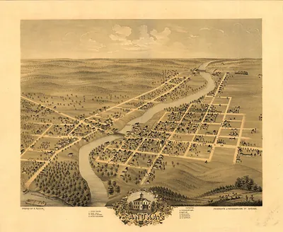
Shakopee, Minnesota, 1869 – Vintage Map Wall Art

(Originally scanned by the Library of Congress. Each image is professionally and digitally cleaned of artifacts such as color bars and extra borders prior to printing.)
Description
Few images capture their era like this antique map of Shakopee, Minnesota, 1869. Sourced directly from the Library of Congress, it represents an authentic piece of documented history.
Library of Congress record: Bird's eye view of Shakopee, Scott County, Minnesota 1869
Order it framed and ready to hang, or unframed to match a frame you already love. It brings character to any room and makes a memorable gift. Free shipping in the lower 48 states. Snapshots of the Past, founded in 2001, has served tens of thousands of customers worldwide.
Shakopee, Minnesota, 1869
Order a print
Thank you. Your order went through, and a receipt is on its way by email.
Secure checkout · SSL encryptedPowered by Stripe and PayPal
Free shipping in the lower 48 states. The checkout page shows the picture, size and price before you pay.
Shakopee, the seat of Scott County, sat on bluffs above the Minnesota River in 1869, only a few years past the upheaval of the 1862 Dakota War. The Dakota people who gave the town its name had been removed from the valley after that conflict, and settlers who arrived in the 1850s and 1860s were now farming and building businesses on land that had been theirs. Wheat dominated the surrounding countryside, and the river and grain trade shaped local commerce. The Minnesota Valley Railroad had reached Shakopee by the mid-1860s, connecting farmers and merchants to the markets of St. Paul and Minneapolis and drawing in new residents.
| Created / published | 1869 |
|---|---|
| Creator | ruger & stoner, chicago lithographing co |
| Notes | Bird's-eye view map. |
| Subjects | Panoramic maps--Minnesota |
| Source | Library of Congress, Panoramic Maps |
| Original scan | 7,088 × 5,480 px · prints to 24 × 18 in at 300 dpi |
| Library of Congress title | Bird's eye view of Shakopee, Scott County, Minnesota 1869 |
| Reference | MN-Shakopee-1869 |
More from the Panoramic Maps collection
Snapshots of the Past helps heritage brands, museums, historians and storytellers tell stories with history: historic prints, image licensing and historical storytelling drawn from more than 25 years of research and curation.