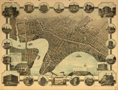
CANADA-Vancouver BC-1878 – Antique Map Print

(Originally scanned by the Library of Congress. Each image is professionally and digitally cleaned of artifacts such as color bars and extra borders prior to printing.)
Description
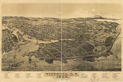
CANADA-Vancouver BC-1878 comes to life in this antique map, reproduced from the original with every detail intact. It comes from the collections of the Library of Congress, scanned from the original and carefully restored.
Library of Congress record: Bird's-eye view of Victoria, Vancouver Island, B.C. 1878
Order it framed and ready to hang, or unframed to match a frame you already love. It brings character to any room and makes a memorable gift. Free shipping in the lower 48 states. Since 2001, Snapshots of the Past has shipped historic prints to tens of thousands of customers around the world.
CANADA-Vancouver BC-1878
Order a print
Thank you. Your order went through, and a receipt is on its way by email.
Secure checkout · SSL encryptedPowered by Stripe and PayPal
Free shipping in the lower 48 states. The checkout page shows the picture, size and price before you pay.
In 1878 the site was Granville, a small sawmill settlement on the south shore of Burrard Inlet, where the Hastings Mill cut timber for ships carrying lumber to overseas markets. Its residents lived in plank houses and boarding shacks near the water, and much of the community's daily life revolved around the mill's payroll and the saloons that served loggers and sailors. British Columbia had joined Canada in 1871 on the promise of a transcontinental railway, but by 1878 that promise was stalled in Ottawa, and the coast still had no rail link to the rest of the country. Ships anchored in the inlet's deep water, which was already recognized as the best harbor on the mainland for large sailing vessels.
| Created / published | 1878 |
|---|---|
| Creator | a.l. bancroft & company, waitt (m.w.) & co, glover, e. s. (eli sheldon) |
| Notes | Bird's-eye view map. |
| Subjects | Panoramic maps-- |
| Source | Library of Congress, Panoramic Maps |
| Original scan | 10,304 × 6,560 px · prints to 34 × 22 in at 300 dpi |
| Library of Congress title | Bird's-eye view of Victoria, Vancouver Island, B.C. 1878 |
| Reference | CANADA-VancouverBC-1878 |
More from the Panoramic Maps collection
Snapshots of the Past helps heritage brands, museums, historians and storytellers tell stories with history: historic prints, image licensing and historical storytelling drawn from more than 25 years of research and curation.