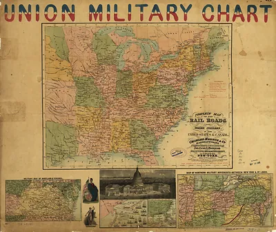
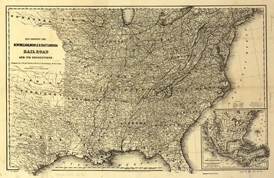
Colton's rail-road and military map of the United States, Mexico, the West Indies, – Vintage Map Wall Art

(Each image is professionally and digitally cleaned of artifacts such as color bars and extra borders prior to printing.)
Description
This rare antique map captures Colton's rail-road and military map of the United States, Mexico, the West Indies, in remarkable detail. It is part of the Snapshots of the Past archive, gathered over 25 years of research.
Choose the framed print, ready to hang the day it arrives, or the unframed print for a frame of your own. A conversation-starting piece for home, office, or as a meaningful gift. Free shipping in the lower 48 states. Snapshots of the Past has been bringing history to the wall since 2001, for tens of thousands of customers worldwide.
Colton's rail-road and military map of the United States, Mexico, the West Indies,
Order a print
Thank you. Your order went through, and a receipt is on its way by email.
Secure checkout · SSL encryptedPowered by Stripe and PayPal
Free shipping in the lower 48 states. The checkout page shows the picture, size and price before you pay.
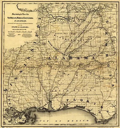
Few Civil War-era maps show the railroad network as plainly as this one, which traces rail lines across the United States, Mexico and the West Indies on a single sheet. Published in 1862 by the New York firm of G. W. & C. B. Colton, it was made for a country at war, when knowing where tracks ran and where troops could move mattered as much as the terrain itself. Alabama, one of the Southern states on the board, is shown with the rail routes that later became strategically important in the conflict. The map today shows how contemporary planners understood transportation and territory during the war.
| Created / published | 1862 |
|---|---|
| Original scan | 12,912 × 9,712 px · prints to 43 × 32 in at 300 dpi |
| Reference | Colton's rail-road and military map of the United States, Mexico, the West Indies, 1862 |
More from the The South collection
Snapshots of the Past helps heritage brands, museums, historians and storytellers tell stories with history: historic prints, image licensing and historical storytelling drawn from more than 25 years of research and curation.