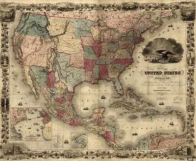
Telegraph Chart of America & Europe – Vintage Wall Art

(Each image is professionally and digitally cleaned of artifacts such as color bars and extra borders prior to printing.)
Description
This historic image of Telegraph Chart of America & Europe brings a moment of history to your wall. Drawn from the Snapshots of the Past archive, it is an authentic piece of documented history.
Order it framed and ready to hang, or unframed to match a frame you already love. A conversation-starting piece for home, office, or as a meaningful gift. Free shipping in the lower 48 states. Snapshots of the Past, founded in 2001, has served tens of thousands of customers worldwide.
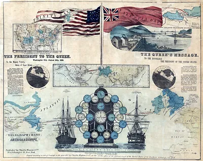
Telegraph Chart of America & Europe
Order a print
Thank you. Your order went through, and a receipt is on its way by email.
Secure checkout · SSL encryptedPowered by Stripe and PayPal
Free shipping in the lower 48 states. The checkout page shows the picture, size and price before you pay.
Rather than a city view, this chart maps the two continents together, tracing the lines that linked North America and Europe by wire. Charts like this rose in popularity in the mid-1800s, when the electric telegraph was spreading across the United States and a cable under the Atlantic was being attempted. The first successful transatlantic cable came in 1866, after earlier attempts failed, and it cut the time for messages between the two sides from weeks by ship to minutes. Maps of this kind show how quickly that new network was reshaping the sense of distance between cities on either shore.
| Original scan | 7,119 × 5,646 px · prints to 24 × 19 in at 300 dpi |
|---|---|
| Reference | 1858a First Atlantic Telegraph |
More from the Across America collection
Snapshots of the Past helps heritage brands, museums, historians and storytellers tell stories with history: historic prints, image licensing and historical storytelling drawn from more than 25 years of research and curation.