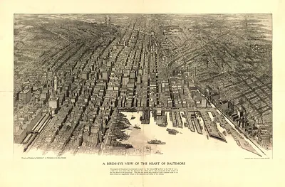
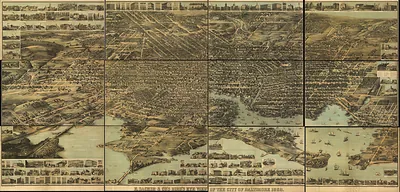
The City of Baltimore, MD, in 1880: View from Washington Monument – Vintage Map Wall Art

(Originally scanned by the Library of Congress. Each image is professionally and digitally cleaned of artifacts such as color bars and extra borders prior to printing.)
Description
This rare antique map captures The City of Baltimore, MD, in 1880: View from Washington Monument in remarkable detail. Sourced directly from the Library of Congress, it represents an authentic piece of documented history.
Library of Congress record: The city of Baltimore City, Md. in 1880 View from Washington Monument looking south
Choose the framed print, ready to hang the day it arrives, or the unframed print for a frame of your own. A fine choice for anyone who loves history, and a gift that gets noticed. Free shipping in the lower 48 states. Snapshots of the Past, founded in 2001, has served tens of thousands of customers worldwide.
The City of Baltimore, MD, in 1880: View from Washington Monument
Order a print
Thank you. Your order went through, and a receipt is on its way by email.
Secure checkout · SSL encryptedPowered by Stripe and PayPal
Free shipping in the lower 48 states. The checkout page shows the picture, size and price before you pay.
The view is taken from the top of the Washington Monument in Mount Vernon Place, the marble column completed in 1829 that was among the first monuments to George Washington in the country. This bird's-eye panorama, issued by the Baltimore firm Sachse & Co. in 1880, shows a busy port city in a period of steady growth, with its harbor, rail lines and dense rowhouse neighborhoods spread below. Maps like this were made for civic pride and for businesses that wanted to advertise, so they record streets, buildings and land use in detail that historians still use today.
| Created / published | 1880 |
|---|---|
| Creator | a. sachse & co |
| Source | Library of Congress, Panoramic Maps |
| Original scan | 4,728 × 3,605 px · prints to 16 × 12 in at 300 dpi |
| Library of Congress title | The city of Baltimore City, Md. in 1880 View from Washington Monument looking south |
| Reference | MD-Baltimore-1880 |
More from the PAN MAPS collection
Snapshots of the Past helps heritage brands, museums, historians and storytellers tell stories with history: historic prints, image licensing and historical storytelling drawn from more than 25 years of research and curation.