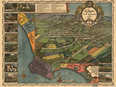
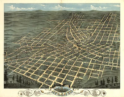
CA Los Angeles 1888 MAP – Antique Map Print

(Each image is professionally and digitally cleaned of artifacts such as color bars and extra borders prior to printing.)
Description
CA Los Angeles 1888 MAP comes to life in this antique map, reproduced from the original with every detail intact. It is part of the Snapshots of the Past archive, gathered over 25 years of research.
The framed print arrives ready to hang; the unframed option suits custom framing. It brings character to any room and makes a memorable gift. Free shipping in the lower 48 states. Since 2001, Snapshots of the Past has shipped historic prints to tens of thousands of customers around the world.
CA Los Angeles 1888 MAP
Order a print
Thank you. Your order went through, and a receipt is on its way by email.
Secure checkout · SSL encryptedPowered by Stripe and PayPal
Free shipping in the lower 48 states. The checkout page shows the picture, size and price before you pay.
This 1888 view shows Los Angeles from an elevated angle, with streets, blocks, and buildings drawn in perspective as if seen from above. It was made during the city's boom years, after the Atchison, Topeka and Santa Fe Railway reached Los Angeles in 1885 and brought a rush of new residents, land speculation, and new construction. Bird's-eye views like this one were popular in the late 1800s because they let towns advertise their growth and let viewers picture a whole community at once. Looking closely, you can see how the city was laid out just before its rapid expansion reshaped the landscape.
| Created / published | 1888 |
|---|---|
| Original scan | 10,728 × 6,208 px · prints to 36 × 21 in at 300 dpi |
| Reference | CA LosAngeles 1888 |
More from the Bird's Eye View Maps collection
Snapshots of the Past helps heritage brands, museums, historians and storytellers tell stories with history: historic prints, image licensing and historical storytelling drawn from more than 25 years of research and curation.