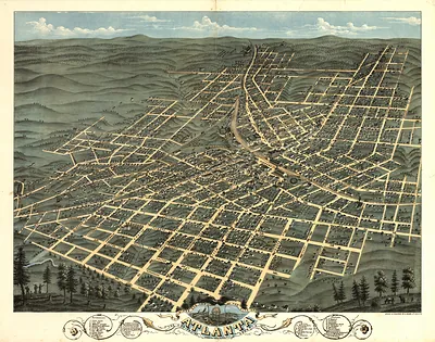
CA Los Angeles 1871 MAP – Antique Wall Map

(Each image is professionally and digitally cleaned of artifacts such as color bars and extra borders prior to printing.)
Description
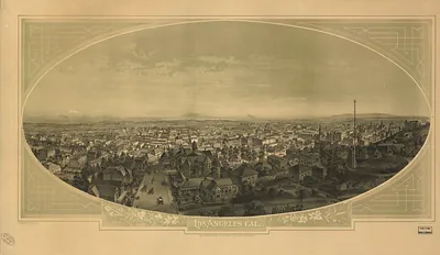
Step back in time with CA Los Angeles 1871 MAP, an antique map rich in period detail. Drawn from the Snapshots of the Past archive, it is an authentic piece of documented history.
Order it framed and ready to hang, or unframed to match a frame you already love. It brings character to any room and makes a memorable gift. Free shipping in the lower 48 states. Snapshots of the Past has been bringing history to the wall since 2001, for tens of thousands of customers worldwide.
CA Los Angeles 1871 MAP
Order a print
Thank you. Your order went through, and a receipt is on its way by email.
Secure checkout · SSL encryptedPowered by Stripe and PayPal
Free shipping in the lower 48 states. The checkout page shows the picture, size and price before you pay.
The 1871 bird's-eye map of Los Angeles shows a town of roughly 6,000 people, still small and dusty, laid out on the grid the Spanish pueblo had used since its founding in 1781. Maps like this were drawn from high vantage points, with each building and street rendered in careful perspective, so viewers could see the whole settlement at once. The year is notable because the Chinese Massacre of 1871 took place in the old Calle de los Negros area that same October, a violent episode that is only faintly visible in the map's neat streets. Viewers today often look to these maps for property lines, lot sizes and the placement of early landmarks.
| Created / published | 1871 |
|---|---|
| Original scan | 3,008 × 2,259 px · prints to 10 × 8 in at 300 dpi |
| Reference | CA-LosAngeles-1871 |
More from the Bird's Eye View Maps collection
Snapshots of the Past helps heritage brands, museums, historians and storytellers tell stories with history: historic prints, image licensing and historical storytelling drawn from more than 25 years of research and curation.