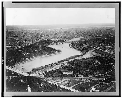
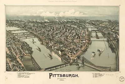
[Aerial view of Pittsburgh, Pennsylvania] / Pittsburgh Aerial Surveys. – Vintage Photo Print

(Originally scanned by the Library of Congress. Each image is professionally and digitally cleaned of artifacts such as color bars and extra borders prior to printing.)
Description
A window into the past: [Aerial view of Pittsburgh, Pennsylvania] / Pittsburgh Aerial Surveys., preserved in this historic photograph. The original is held by the Library of Congress, so what you hang is a true record of its time.
Order it framed and ready to hang, or unframed to match a frame you already love. Perfect for a home, office, library or classroom wall, and a gift with a story behind it. Free shipping in the lower 48 states. Snapshots of the Past, founded in 2001, has served tens of thousands of customers worldwide.
[Aerial view of Pittsburgh, Pennsylvania] / Pittsburgh Aerial Surveys.
Order a print
Thank you. Your order went through, and a receipt is on its way by email.
Secure checkout · SSL encryptedPowered by Stripe and PayPal
Free shipping in the lower 48 states. The checkout page shows the picture, size and price before you pay.
Here the camera looks down on the downtown business district, where the Monongahela and Allegheny rivers meet to form the Ohio, a junction that shaped Pittsburgh's growth from its earliest years. The print dates to about 1930 and was issued under the name Pittsburgh Aerial Surveys, with copyright held by the Pittsburgh Aviation Management Corp., at a time when airplane photography of American cities was still relatively new. Pittsburgh was then one of the country's great industrial centers, with mills and rail lines crowded along its rivers, so an overhead view like this one shows how tightly the streets, bridges and waterfront were packed together.
| Created / published | c1930. |
|---|---|
| Medium | 1 photographic print. |
| Genre | Aerial photographs 1930.Photographic prints 1930. |
| Notes | Copyright by Pittsburgh Aviation Management Corp., Pittsburgh, Pa. |
| Subjects | Business districts--Pennsylvania--Pittsburgh--1930. Pittsburgh (Pa.)--1930. Monongahela River (W.Va. and Pa.)--1930. Allegheny River (Pa. and N.Y.)--1930. |
| Source | Library of Congress, Prints and Photographs Division |
| Original scan | 4,096 × 3,291 px · prints to 14 × 11 in at 300 dpi |
| Reference | AMZ-SOTP-HPA-184576 |
More from the Pittsburgh collection
Snapshots of the Past helps heritage brands, museums, historians and storytellers tell stories with history: historic prints, image licensing and historical storytelling drawn from more than 25 years of research and curation.