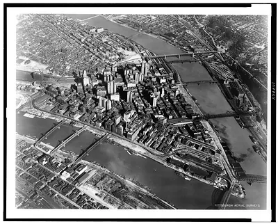
Pittsburgh, Pennsylvania, 1902 bird's-eye view map – Antique Map Print

(Each image is professionally and digitally cleaned of artifacts such as color bars and extra borders prior to printing.)
Description
Step back in time with Pittsburgh, Pennsylvania, 1902 bird's-eye view map, an antique map rich in period detail. It comes from the Snapshots of the Past collection, curated over 25 years for its historical value.
Order it framed and ready to hang, or unframed to match a frame you already love. It brings character to any room and makes a memorable gift. Free shipping in the lower 48 states. Snapshots of the Past has been bringing history to the wall since 2001, for tens of thousands of customers worldwide.
Pittsburgh, Pennsylvania, 1902 bird's-eye view map
Order a print
Thank you. Your order went through, and a receipt is on its way by email.
Secure checkout · SSL encryptedPowered by Stripe and PayPal
Free shipping in the lower 48 states. The checkout page shows the picture, size and price before you pay.
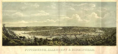
Pittsburgh sits where the Allegheny and Monongahela rivers meet to form the Ohio, and a bird's-eye view from 1902 shows how tightly the city was packed into that wedge of land. Maps like this were drawn by artists who sketched streets, rail lines, and major buildings from an imagined height, giving viewers a sense of the whole city at once. By 1902 Pittsburgh was a center of steel, glass, and rail manufacturing, and the smoke-heavy industry along the rivers was the engine behind its rapid growth. Looking closely at the map, you can trace the river bends, the dense downtown grid, and the hillside neighborhoods that climbed above the mills.
| Created / published | 1902 |
|---|---|
| Original scan | 1,024 × 685 px |
| Reference | PA Pittsburgh 1902 |
More from the Pittsburgh collection
Snapshots of the Past helps heritage brands, museums, historians and storytellers tell stories with history: historic prints, image licensing and historical storytelling drawn from more than 25 years of research and curation.