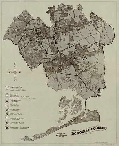
Map of Borough of Queens, Supplement to the Brooklyn Eagle Almanac 1922 – Vintage Map Wall Art

(Each image is professionally and digitally cleaned of artifacts such as color bars and extra borders prior to printing.)
Description
Step back in time with Map of Borough of Queens, Supplement to the Brooklyn Eagle Almanac 1922, an antique map rich in period detail. Drawn from the Snapshots of the Past archive, it is an authentic piece of documented history.
The framed print arrives ready to hang; the unframed option suits custom framing. A conversation-starting piece for home, office, or as a meaningful gift. Free shipping in the lower 48 states. Since 2001, Snapshots of the Past has shipped historic prints to tens of thousands of customers around the world.
Map of Borough of Queens, Supplement to the Brooklyn Eagle Almanac 1922
Order a print
Thank you. Your order went through, and a receipt is on its way by email.
Secure checkout · SSL encryptedPowered by Stripe and PayPal
Free shipping in the lower 48 states. The checkout page shows the picture, size and price before you pay.
Queens appears here as one of the five boroughs of New York City, a status it gained when the city consolidated in 1898. The map was issued as a supplement to the *Brooklyn Eagle Almanac*, a yearly reference volume from the Brooklyn Daily Eagle, so it was meant to be used alongside local news and information rather than as a standalone atlas. Its layout reflects the early 1920s, when transit lines and new development were steadily drawing residents into Queens's outer neighborhoods.
| Created / published | 1922 |
|---|---|
| Original scan | 3,000 × 3,587 px · prints to 10 × 12 in at 300 dpi |
| Reference | NY Queens Williams Map & Guide Co A 1922 |
More from the PAN MAPS collection
Snapshots of the Past helps heritage brands, museums, historians and storytellers tell stories with history: historic prints, image licensing and historical storytelling drawn from more than 25 years of research and curation.