Bay Side Park, Borough of Queens, New York City – Antique Map Print

(Each image is professionally and digitally cleaned of artifacts such as color bars and extra borders prior to printing.)
Description
Step back in time with Bay Side Park, Borough of Queens, New York City, an antique map rich in period detail. It is part of the Snapshots of the Past archive, gathered over 25 years of research.
Framed, it is ready for the wall; unframed, it is ready for the frame you choose. It makes a striking addition to a living room, study or office, and a thoughtful gift. Free shipping in the lower 48 states. Since 2001, Snapshots of the Past has shipped historic prints to tens of thousands of customers around the world.
Bay Side Park, Borough of Queens, New York City
Order a print
Thank you. Your order went through, and a receipt is on its way by email.
Secure checkout · SSL encryptedPowered by Stripe and PayPal
Free shipping in the lower 48 states. The checkout page shows the picture, size and price before you pay.
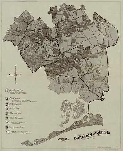
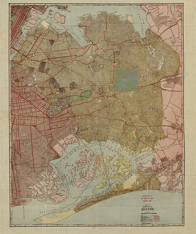
Bay Side Park sat on the northern edge of Queens, where the village of Bayside grew up along Little Neck Bay and the Long Island Sound shore. Pictures from 1915 caught the neighborhood in the years when the Long Island Rail Road and trolley lines were pulling Manhattan commuters out to the quieter waterfront towns of eastern Queens. A map of this kind, reduced for a wider view of the region, shows how small parks and shorelines like this one were tied into the growing road and rail network of New York City. Its scale also reminds viewers how much of Queens was still open land and water before the borough filled in during the twentieth century.
| Created / published | 1915 |
|---|---|
| Original scan | 4,351 × 3,997 px · prints to 15 × 13 in at 300 dpi |
| Reference | NY Queens 1915 |
More from the PAN MAPS collection
Snapshots of the Past helps heritage brands, museums, historians and storytellers tell stories with history: historic prints, image licensing and historical storytelling drawn from more than 25 years of research and curation.