A Map of the Most Inhabited Part of New England – Vintage Map Wall Art

(Each image is professionally and digitally cleaned of artifacts such as color bars and extra borders prior to printing.)
Description
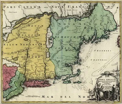
Few images capture their era like this antique map of A Map of the Most Inhabited Part of New England. It is part of the Snapshots of the Past archive, gathered over 25 years of research.
Framed, it is ready for the wall; unframed, it is ready for the frame you choose. It brings character to any room and makes a memorable gift. Free shipping in the lower 48 states. Snapshots of the Past, founded in 2001, has served tens of thousands of customers worldwide.
A Map of the Most Inhabited Part of New England
Order a print
Thank you. Your order went through, and a receipt is on its way by email.
Secure checkout · SSL encryptedPowered by Stripe and PayPal
Free shipping in the lower 48 states. The checkout page shows the picture, size and price before you pay.
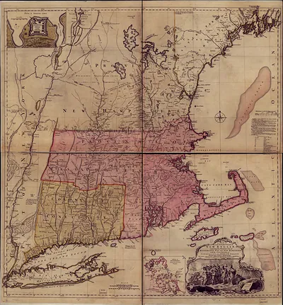
Rather than covering all of New England, this map zeroes in on its most densely settled core, the towns clustered around Massachusetts Bay and the Connecticut colony. Maps like this were prepared in the colonial period, when European publishers and colonial surveyors were working to chart coastlines, harbors, and the growing network of roads and towns for trade and administration. Worth noticing is how the mapmakers decided what counted as "inhabited," since the emphasis reflects settlement patterns and the commercial interests that drove the region's development.
| Original scan | 883 × 947 px |
|---|---|
| Reference | New England Thos Jefferys, 1755 low rez |
More from the New England collection
Snapshots of the Past helps heritage brands, museums, historians and storytellers tell stories with history: historic prints, image licensing and historical storytelling drawn from more than 25 years of research and curation.