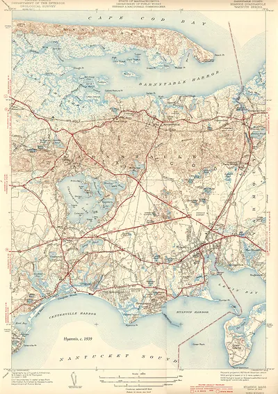
Dennis, Massachusetts USGS topographic map, 1943 – Antique Map Print

(Each image is professionally and digitally cleaned of artifacts such as color bars and extra borders prior to printing.)
Description
Step back in time with Dennis, Massachusetts USGS topographic map, 1943, an antique map rich in period detail. Drawn from the Snapshots of the Past archive, it is an authentic piece of documented history.
The framed print arrives ready to hang; the unframed option suits custom framing. It brings character to any room and makes a memorable gift. Free shipping in the lower 48 states. Snapshots of the Past, founded in 2001, has served tens of thousands of customers worldwide.
Dennis, Massachusetts USGS topographic map, 1943
Order a print
Thank you. Your order went through, and a receipt is on its way by email.
Secure checkout · SSL encryptedPowered by Stripe and PayPal
Free shipping in the lower 48 states. The checkout page shows the picture, size and price before you pay.
Dennis lies along the middle of Cape Cod's elbow, with one shore on Cape Cod Bay and the other on Nantucket Sound, and its villages of West Dennis, South Dennis and Dennis Port spread between them. This 1943 U.S. Geological Survey quadrangle dates from the middle of World War II, when the federal government was keeping its detailed mapping of the country up to date and the Cape hosted military training and coastal defense activity. Sheets like this one record roads, marshes, ponds and contour lines at a fine scale, which makes them useful for seeing how the town's harbors and low, sandy terrain took shape.
| Created / published | 1943 |
|---|---|
| Original scan | 750 × 2,550 px · prints to 2 × 8 in at 300 dpi |
| Reference | MA-Dennis USGS 1943 |
More from the PAN MAPS collection
Snapshots of the Past helps heritage brands, museums, historians and storytellers tell stories with history: historic prints, image licensing and historical storytelling drawn from more than 25 years of research and curation.