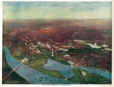
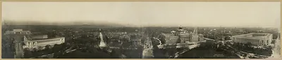
Washington, the Mall and Vicinity, Public Buildings Occupied by Various Government Activities, 1917 – Vintage Photo Print

(Each image is professionally and digitally cleaned of artifacts such as color bars and extra borders prior to printing.)
Description
A window into the past: Washington, the Mall and Vicinity, Public Buildings Occupied by Various Government Activities, 1917, preserved in this antique map. Drawn from the Snapshots of the Past archive, it is an authentic piece of documented history.
Framed, it is ready for the wall; unframed, it is ready for the frame you choose. A conversation-starting piece for home, office, or as a meaningful gift. Free shipping in the lower 48 states. Snapshots of the Past has been bringing history to the wall since 2001, for tens of thousands of customers worldwide.
Washington, the Mall and Vicinity, Public Buildings Occupied by Various Government Activities, 1917
Order a print
Thank you. Your order went through, and a receipt is on its way by email.
Secure checkout · SSL encryptedPowered by Stripe and PayPal
Free shipping in the lower 48 states. The checkout page shows the picture, size and price before you pay.
This color map charts which federal offices occupied which buildings around the National Mall in 1917, so it records the government's working geography as well as the city's streets. That mapping matters because the federal workforce was expanding quickly, and the United States' entry into the First World War that spring pushed agencies to find space wherever they could. The sheet was issued under the Public Buildings Commission and printed by Norris Peters Co. of Washington, and its large format folds down to a size that could be carried through the city. It offers a useful snapshot of the capital just before wartime growth reshaped it further.
| Created / published | 1917 |
|---|---|
| Medium | map, color, 57 x 125 cm, folded to 26 x 18 cm |
| Notes | Public Buildings Commission. Washington, DC: Norris Peters Co |
| Original scan | 4,800 × 2,252 px · prints to 16 × 8 in at 300 dpi |
| Reference | 1917 ct000616 |
More from the U.S. Capitol collection
Snapshots of the Past helps heritage brands, museums, historians and storytellers tell stories with history: historic prints, image licensing and historical storytelling drawn from more than 25 years of research and curation.