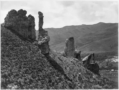
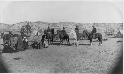
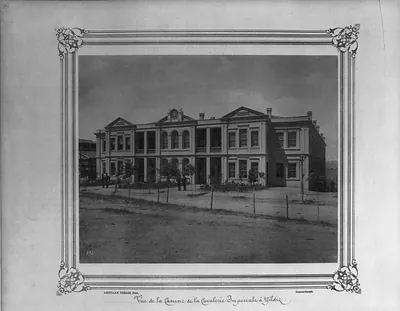
Cottonwood Lake, Utah (Wahsatch) / T. H. O'Sullivan, phot. – Historic Print

(Originally scanned by the Library of Congress. Each image is professionally and digitally cleaned of artifacts such as color bars and extra borders prior to printing.)
Description
This rare historic photograph captures Cottonwood Lake, Utah (Wahsatch) / T. H. O'Sullivan, phot. in remarkable detail. It comes from the collections of the Library of Congress, scanned from the original and carefully restored.
Framed, it is ready for the wall; unframed, it is ready for the frame you choose. Perfect for a home, office, library or classroom wall, and a gift with a story behind it. Free shipping in the lower 48 states. Since 2001, Snapshots of the Past has shipped historic prints to tens of thousands of customers around the world.
Cottonwood Lake, Utah (Wahsatch) / T. H. O'Sullivan, phot.
Order a print
Thank you. Your order went through, and a receipt is on its way by email.
Secure checkout · SSL encryptedPowered by Stripe and PayPal
Free shipping in the lower 48 states. The checkout page shows the picture, size and price before you pay.
Cottonwood Lake in the Wahsatch range is the subject here, and the plate number scratched into the emulsion marks it as one of the survey's own views. Timothy H. O'Sullivan made the photograph around 1869 while working for Clarence King's Geological Exploration of the Fortieth Parallel, a federal survey that mapped and studied the land along the 40th parallel from the Great Plains to the Sierra Nevada. Like many images from the expedition, it was meant as a record of terrain and geology, so its value lies in documenting the high mountain landscape as much as in its composition. The albumen print preserves that record in the fine tonal detail typical of the period.
| Created / published | [1869] |
|---|---|
| Medium | 1 photographic print : albumen. |
| Notes | Plate 153 from: Geological Exploration of the Fortieth Parallel / United States Army Corps of Engineers; Clarence King, geologist in charge. [Washington, D.C.; 187-?]. Title from item. 153" scratched in emulsion |
| Subjects | United States Geological Exploration of the Fortieth Parallel--(1867-1881) |
| Source | Library of Congress, Prints and Photographs Division |
| Original scan | 1,536 × 1,154 px · prints to 5 × 4 in at 300 dpi |
| Reference | AMZ-SOTP-HPA-142566 |
More from the Historic Print Archive collection
Snapshots of the Past helps heritage brands, museums, historians and storytellers tell stories with history: historic prints, image licensing and historical storytelling drawn from more than 25 years of research and curation.