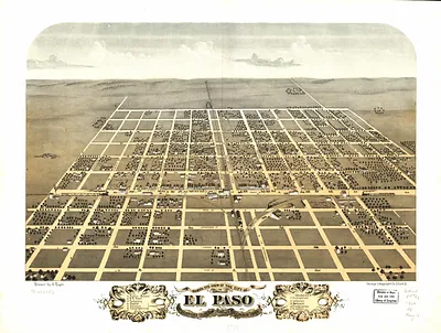
Loda, Illinois, 1869 – Historic Map Reproduction

(Originally scanned by the Library of Congress. Each image is professionally and digitally cleaned of artifacts such as color bars and extra borders prior to printing.)
Description
Step back in time with Loda, Illinois, 1869, an antique map rich in period detail. The original is held by the Library of Congress, so what you hang is a true record of its time.
Library of Congress record: Bird's eye view of Loda, Iroquois Co., Illinois 1869
Framed, it is ready for the wall; unframed, it is ready for the frame you choose. It makes a striking addition to a living room, study or office, and a thoughtful gift. Free shipping in the lower 48 states. Snapshots of the Past has been bringing history to the wall since 2001, for tens of thousands of customers worldwide.
Loda, Illinois, 1869
Order a print
Thank you. Your order went through, and a receipt is on its way by email.
Secure checkout · SSL encryptedPowered by Stripe and PayPal
Free shipping in the lower 48 states. The checkout page shows the picture, size and price before you pay.
Loda, in Iroquois County, sat on the open prairie of east-central Illinois in 1869, a village whose fortunes rested on corn, oats, hogs, and cattle raised on the surrounding farms. Five years after the Civil War ended, many of the county's families were still clearing sod, fencing fields, and digging drainage ditches to make the wet prairie soil productive. Grain and livestock moved by wagon and rail to Chicago, the regional market city about 100 miles north, so Loda's prosperity depended on the rail connections and commercial ties that linked small farm towns to that larger center. Local life revolved around the churches, schools, general stores, and grain elevators that marked the village's few streets, and residents would have known Loda first as a farm trading point.
| Created / published | 1869 |
|---|---|
| Creator | ruger, a., chicago lithographing co |
| Notes | Bird's-eye view map. |
| Subjects | Panoramic maps--Illinois |
| Source | Library of Congress, Panoramic Maps |
| Original scan | 6,432 × 5,008 px · prints to 21 × 17 in at 300 dpi |
| Library of Congress title | Bird's eye view of Loda, Iroquois Co., Illinois 1869 |
| Reference | IL-Loda-1869 |
More from the Panoramic Maps collection
Snapshots of the Past helps heritage brands, museums, historians and storytellers tell stories with history: historic prints, image licensing and historical storytelling drawn from more than 25 years of research and curation.