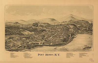
Schuylerville, New York, 1889 – Historic Map Reproduction

(Originally scanned by the Library of Congress. Each image is professionally and digitally cleaned of artifacts such as color bars and extra borders prior to printing.)
Description
This antique map of Schuylerville, New York, 1889 brings a moment of history to your wall. Sourced directly from the Library of Congress, it represents an authentic piece of documented history.
Library of Congress record: Schuylerville, N.Y.
Choose the framed print, ready to hang the day it arrives, or the unframed print for a frame of your own. Perfect for a home, office, library or classroom wall, and a gift with a story behind it. Free shipping in the lower 48 states. Snapshots of the Past has been bringing history to the wall since 2001, for tens of thousands of customers worldwide.
Schuylerville, New York, 1889
Order a print
Thank you. Your order went through, and a receipt is on its way by email.
Secure checkout · SSL encryptedPowered by Stripe and PayPal
Free shipping in the lower 48 states. The checkout page shows the picture, size and price before you pay.
Schuylerville, in Saratoga County on the Hudson River, was a small canal and mill village in 1889, and its residents lived alongside the ground where British General John Burgoyne surrendered to American forces in October 1777. The Champlain Canal ran nearby and carried boats and freight past the village, supporting local trade in grain, lumber, and manufactured goods. Mills powered by the streams that flow into the Hudson gave work to many families, and the village's civic life centered on its churches, schools, and stores. Locals took pride in the battle history that the village's older names recalled, and that memory shaped how they described their town to visitors. The bird's-eye view shows the village as its own community at the end of the nineteenth century, still tied to the river and the old battle ground.
| Created / published | 1889 |
|---|---|
| Creator | burleigh litho, burleigh, l. r. |
| Notes | Bird's-eye view map. |
| Subjects | Panoramic maps--New York |
| Source | Library of Congress, Panoramic Maps |
| Original scan | 8,352 × 5,312 px · prints to 28 × 18 in at 300 dpi |
| Library of Congress title | Schuylerville, N.Y. |
| Reference | NY Schuylerville 1889 |
More from the Panoramic Maps collection
Snapshots of the Past helps heritage brands, museums, historians and storytellers tell stories with history: historic prints, image licensing and historical storytelling drawn from more than 25 years of research and curation.