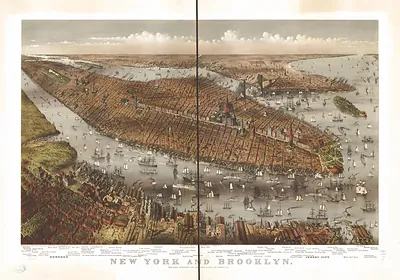
New York, New York, 1856 – Antique Map Print

(Each image is professionally and digitally cleaned of artifacts such as color bars and extra borders prior to printing.)
Description
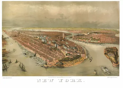
This antique map of New York, New York, 1856 brings a moment of history to your wall. It comes from the Snapshots of the Past collection, curated over 25 years for its historical value.
Order it framed and ready to hang, or unframed to match a frame you already love. A conversation-starting piece for home, office, or as a meaningful gift. Free shipping in the lower 48 states. Since 2001, Snapshots of the Past has shipped historic prints to tens of thousands of customers around the world.
New York, New York, 1856
Order a print
Thank you. Your order went through, and a receipt is on its way by email.
Secure checkout · SSL encryptedPowered by Stripe and PayPal
Free shipping in the lower 48 states. The checkout page shows the picture, size and price before you pay.
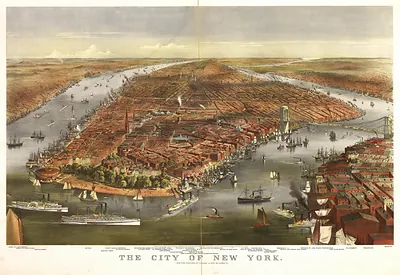
New York City in 1856 was a city of roughly 600,000 people, already the largest in the United States and the country's busiest port. Ships from around the world docked along the East River and the Hudson, and the wharves, warehouses and counting houses of lower Manhattan handled much of the nation's cotton, grain and imported dry goods. The city had only recently been drawn into a grid of streets above Houston Street, and the Croton Aqueduct, completed in 1842, still supplied its water. Politics was loud and factional, with Tammany Hall, the Know-Nothing movement and fierce newspaper rivalries shaping city life, while the Crystal Palace exhibition of 1853 had already shown New Yorkers how far their city had come.
| Created / published | 1856 |
|---|---|
| Notes | Bird's-eye view map. |
| Subjects | Panoramic maps--New York |
| Original scan | 9,420 × 7,702 px · prints to 31 × 26 in at 300 dpi |
| Reference | NY New York 1856 |
More from the Panoramic Maps collection
Snapshots of the Past helps heritage brands, museums, historians and storytellers tell stories with history: historic prints, image licensing and historical storytelling drawn from more than 25 years of research and curation.