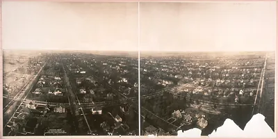
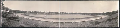
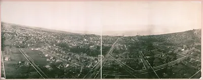
Fort Sheridan 600 ft elevation, Illinois, 1908 – Historic Photo Reproduction

(Originally scanned by the Library of Congress. Each image is professionally and digitally cleaned of artifacts such as color bars and extra borders prior to printing.)
Description
This rare historic image captures Fort Sheridan 600 ft elevation, Illinois, 1908 in remarkable detail. An authentic image from the Library of Congress, it carries the weight of the real historical record.
Library of Congress record: Fort Sheridan, Ill., 600 ft. elevation
Choose the framed print, ready to hang the day it arrives, or the unframed print for a frame of your own. A conversation-starting piece for home, office, or as a meaningful gift. Free shipping in the lower 48 states. Snapshots of the Past has been bringing history to the wall since 2001, for tens of thousands of customers worldwide.
Fort Sheridan 600 ft elevation, Illinois, 1908
Order a print
Thank you. Your order went through, and a receipt is on its way by email.
Secure checkout · SSL encryptedPowered by Stripe and PayPal
Free shipping in the lower 48 states. The checkout page shows the picture, size and price before you pay.
Fort Sheridan sat on the bluffs above Lake Michigan in Lake County, Illinois, roughly 25 miles north of downtown Chicago, when this panorama was made in 1908. The post had been established in the late 1880s and was named for Gen. Philip Sheridan, and by the early 1900s it served as a major garrison for the Army in the Midwest. Its troops had been called out during the Pullman Strike of 1894, an episode that tied the fort to the labor and civic unrest of the city. In 1908 Chicago was a rapidly expanding industrial and rail center, and the lakeshore towns to the north were growing as commuter suburbs. Residents of the North Shore would have known the fort as a military landmark on the lake, set against the wooded ravines and open lake views that drew summer visitors.
| Created / published | 1908 |
|---|---|
| Creator | geo. r. lawrence co. |
| Notes | Panoramic photograph. |
| Subjects | Panoramic photographs--Illinois |
| Source | Library of Congress, Panoramic Photographs |
| Original scan | 5,190 × 1,554 px · prints to 17 × 5 in at 300 dpi |
| Library of Congress title | Fort Sheridan, Ill., 600 ft. elevation |
| Reference | IL Fort Sheridan 600 ft elevation 1908 |
More from the Panoramic Photos collection
Snapshots of the Past helps heritage brands, museums, historians and storytellers tell stories with history: historic prints, image licensing and historical storytelling drawn from more than 25 years of research and curation.