MA-Cambridge-Charles River-1853 – Vintage Map Wall Art

(Each image is professionally and digitally cleaned of artifacts such as color bars and extra borders prior to printing.)
Description
This antique map of MA-Cambridge-Charles River-1853 brings a moment of history to your wall. It is part of the Snapshots of the Past archive, gathered over 25 years of research.
Order it framed and ready to hang, or unframed to match a frame you already love. A conversation-starting piece for home, office, or as a meaningful gift. Free shipping in the lower 48 states. Snapshots of the Past has been bringing history to the wall since 2001, for tens of thousands of customers worldwide.
MA-Cambridge-Charles River-1853
Order a print
Thank you. Your order went through, and a receipt is on its way by email.
Secure checkout · SSL encryptedPowered by Stripe and PayPal
Free shipping in the lower 48 states. The checkout page shows the picture, size and price before you pay.
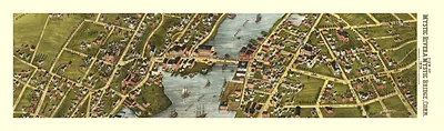
The Charles River at Cambridge is the subject here, so the view centers on a particular stretch of water rather than a general town scene. By 1853 the river marked the boundary between Cambridge and Boston, crossed by bridges that had carried traffic since the late eighteenth century, and the shoreline was changing from farmland and mill sites toward the streets of an incorporated city. Harvard, founded in 1636, sat about a mile inland, so the college shaped how the town appeared to anyone traveling along the water. The record offers little beyond the place and year, so the picture is best read as a snapshot of a river town in transition.
| Original scan | 1,513 × 600 px · prints to 5 × 2 in at 300 dpi |
|---|---|
| Reference | MA-Cambridge-Charles River-1853 |
More from the PAN MAPS collection
Snapshots of the Past helps heritage brands, museums, historians and storytellers tell stories with history: historic prints, image licensing and historical storytelling drawn from more than 25 years of research and curation.