CT Mystic River 1879 MAP – Antique Wall Map

(Each image is professionally and digitally cleaned of artifacts such as color bars and extra borders prior to printing.)
Description
This antique map of CT Mystic River 1879 MAP brings a moment of history to your wall. It is part of the Snapshots of the Past archive, gathered over 25 years of research.
Framed, it is ready for the wall; unframed, it is ready for the frame you choose. It makes a striking addition to a living room, study or office, and a thoughtful gift. Free shipping in the lower 48 states. Snapshots of the Past, founded in 2001, has served tens of thousands of customers worldwide.
CT Mystic River 1879 MAP
Order a print
Thank you. Your order went through, and a receipt is on its way by email.
Secure checkout · SSL encryptedPowered by Stripe and PayPal
Free shipping in the lower 48 states. The checkout page shows the picture, size and price before you pay.
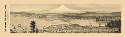
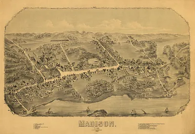
Few places in New England were as tied to the water as Mystic, where the river meets Long Island Sound in southeastern Connecticut. This 1879 view shows the village as it stood in the late 1800s, when shipyards along the river built wooden vessels and the harbor handled a steady flow of coastal trade. Maps of this kind were usually drawn from an elevated angle so that streets, wharves, and rooflines could be read at a glance by residents and visitors alike. Look closely at the waterfront to see how the built landscape followed the curve of the river.
| Created / published | 1879 |
|---|---|
| Original scan | 2,550 × 750 px · prints to 8 × 2 in at 300 dpi |
| Reference | CT-MysticRiver-1879 |
More from the PAN MAPS collection
Snapshots of the Past helps heritage brands, museums, historians and storytellers tell stories with history: historic prints, image licensing and historical storytelling drawn from more than 25 years of research and curation.