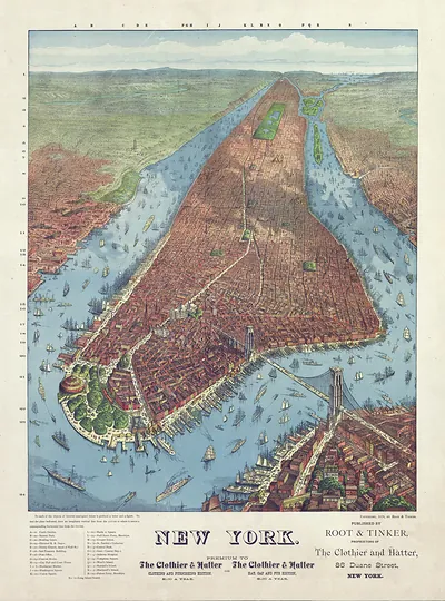
Map of Manhattan Island with street grid plan – Antique Map Print

(Each image is professionally and digitally cleaned of artifacts such as color bars and extra borders prior to printing.)
Description
This rare antique map captures Map of Manhattan Island with street grid plan in remarkable detail. Drawn from the Snapshots of the Past archive, it is an authentic piece of documented history.
The framed print arrives ready to hang; the unframed option suits custom framing. A fine choice for anyone who loves history, and a gift that gets noticed. Free shipping in the lower 48 states. Snapshots of the Past has been bringing history to the wall since 2001, for tens of thousands of customers worldwide.
Map of Manhattan Island with street grid plan
Order a print
Thank you. Your order went through, and a receipt is on its way by email.
Secure checkout · SSL encryptedPowered by Stripe and PayPal
Free shipping in the lower 48 states. The checkout page shows the picture, size and price before you pay.
Few maps show Manhattan's future as clearly as this one, which dates to 1811, the year city commissioners adopted a plan for the island's streets. The plan imposed a rigid grid of numbered avenues and cross streets over farmland and rocky ground north of the built-up southern tip, a scheme that would shape the city for the next two centuries. The Battery, where Castle Clinton stands, was the point from which that growth began. The fort, finished in 1811 on an artificial island just offshore, was built to guard the harbor as tensions with Britain led toward the War of 1812.
| Created / published | 1811 |
|---|---|
| Original scan | 14,889 × 4,264 px · prints to 50 × 14 in at 300 dpi |
| Reference | NY Manhattan 1811 |
More from the More National Park Sites collection
Snapshots of the Past helps heritage brands, museums, historians and storytellers tell stories with history: historic prints, image licensing and historical storytelling drawn from more than 25 years of research and curation.