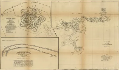
Southern Mississippi and Alabama showing the approaches to Mobile., Alabama, 1863 – Vintage Map Wall Art

(Each image is professionally and digitally cleaned of artifacts such as color bars and extra borders prior to printing.)
Description
This antique map of Southern Mississippi and Alabama showing the approaches to Mobile., Alabama, 1863 brings a moment of history to your wall. It is part of the Snapshots of the Past archive, gathered over 25 years of research.
Order it framed and ready to hang, or unframed to match a frame you already love. It makes a striking addition to a living room, study or office, and a thoughtful gift. Free shipping in the lower 48 states. Since 2001, Snapshots of the Past has shipped historic prints to tens of thousands of customers around the world.
Southern Mississippi and Alabama showing the approaches to Mobile., Alabama, 1863
Order a print
Thank you. Your order went through, and a receipt is on its way by email.
Secure checkout · SSL encryptedPowered by Stripe and PayPal
Free shipping in the lower 48 states. The checkout page shows the picture, size and price before you pay.
The map's view takes in southern Mississippi and Alabama, with attention on the land and water routes converging on Mobile, the Gulf port that was among the last major Confederate strongholds on the coast. A bird's-eye panorama like this one lets a viewer see rivers, roads, bays, and settlements at a glance, which made such maps useful to officers planning movements and supply in unfamiliar country. Mobile's harbor, guarded by forts at the mouth of Mobile Bay, was a central problem for Union strategists throughout the war, and the map reflects that interest in the approaches rather than the city alone.
| Created / published | 1863 |
|---|---|
| Notes | Bird's-eye view map. |
| Subjects | Panoramic maps--Alabama |
| Original scan | 3,880 × 3,647 px · prints to 13 × 12 in at 300 dpi |
| Reference | Southern Mississippi and Alabama showing the approaches to Mobile. 1863 |
More from the PAN MAPS collection
Snapshots of the Past helps heritage brands, museums, historians and storytellers tell stories with history: historic prints, image licensing and historical storytelling drawn from more than 25 years of research and curation.