View of Sacramento City as it appeared during the great inundation in January 1850 – Historic Map Reproduction

(Originally scanned by the Library of Congress. Each image is professionally and digitally cleaned of artifacts such as color bars and extra borders prior to printing.)
Description
Step back in time with View of Sacramento City as it appeared during the great inundation in January 1850, an antique map rich in period detail. It comes from the collections of the Library of Congress, scanned from the original and carefully restored.
Choose the framed print, ready to hang the day it arrives, or the unframed print for a frame of your own. A fine choice for anyone who loves history, and a gift that gets noticed. Free shipping in the lower 48 states. Since 2001, Snapshots of the Past has shipped historic prints to tens of thousands of customers around the world.
View of Sacramento City as it appeared during the great inundation in January 1850
Order a print
Thank you. Your order went through, and a receipt is on its way by email.
Secure checkout · SSL encryptedPowered by Stripe and PayPal
Free shipping in the lower 48 states. The checkout page shows the picture, size and price before you pay.
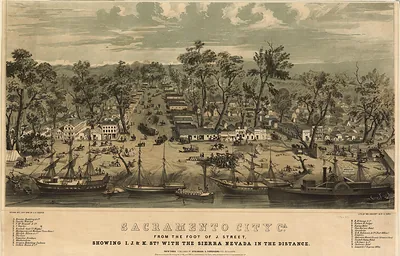
Sacramento's streets are shown underwater in this view of the city during the flooding of January 1850, when the rivers rose over the low ground where the town sat at the meeting of the Sacramento and American rivers. The city had been built quickly during the Gold Rush, and its position on flat, poorly drained land left it vulnerable to repeated floods. The record credits Napoleon Sarony, George W. Casilear, and Henry Bainbridge with the image, which places the flood in a panoramic format that let viewers take in the whole waterlogged town at once.
| Created / published | 1850 |
|---|---|
| Creator | sarony, napoleon, casilear, george w., bainbridge, henry |
| Source | Library of Congress, Panoramic Maps |
| Original scan | 5,582 × 3,912 px · prints to 19 × 13 in at 300 dpi |
| Library of Congress title | View of Sacramento City as it appeared during the great inundation in January 1850 |
| Reference | CA-SacramentoFloodB-1850 |
More from the PAN MAPS collection
Snapshots of the Past helps heritage brands, museums, historians and storytellers tell stories with history: historic prints, image licensing and historical storytelling drawn from more than 25 years of research and curation.