Plan of the City intended for the permanent seat of the Government – Antique Wall Map

(Each image is professionally and digitally cleaned of artifacts such as color bars and extra borders prior to printing.)
Description
Step back in time with Plan of the City intended for the permanent seat of the Government, an antique map rich in period detail. It is part of the Snapshots of the Past archive, gathered over 25 years of research.
The framed print arrives ready to hang; the unframed option suits custom framing. A fine choice for anyone who loves history, and a gift that gets noticed. Free shipping in the lower 48 states. Since 2001, Snapshots of the Past has shipped historic prints to tens of thousands of customers around the world.
Plan of the City intended for the permanent seat of the Government
Order a print
Thank you. Your order went through, and a receipt is on its way by email.
Secure checkout · SSL encryptedPowered by Stripe and PayPal
Free shipping in the lower 48 states. The checkout page shows the picture, size and price before you pay.
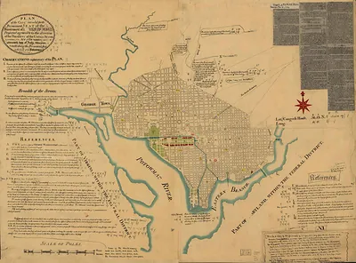
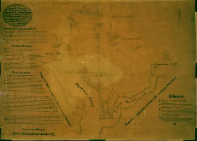
Pierre Charles L'Enfant drew this plan in 1791 to lay out the capital the new federal government would occupy, and its radiating avenues, named for the states, meet at circles and open squares. The Capitol and the President's House anchor the design as its main focal points. Andrew Ellicott engraved and published the plan in 1792, after L'Enfant had already been dismissed amid disputes with the commissioners overseeing the project. Much of the street pattern shown here still shapes Washington today.
| Original scan | 2,537 × 1,823 px · prints to 8 × 6 in at 300 dpi |
|---|---|
| Reference | L'Enfant-1 |
More from the PAN MAPS collection
Snapshots of the Past helps heritage brands, museums, historians and storytellers tell stories with history: historic prints, image licensing and historical storytelling drawn from more than 25 years of research and curation.