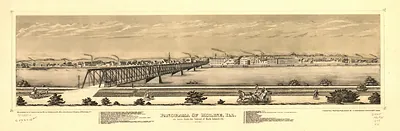
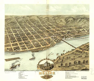
Moline, Illinois, 1889 – Vintage Map Wall Art

(Originally scanned by the Library of Congress. Each image is professionally and digitally cleaned of artifacts such as color bars and extra borders prior to printing.)
Description
Few images capture their era like this antique map of Moline, Illinois, 1889. An authentic image from the Library of Congress, it carries the weight of the real historical record.
Library of Congress record: Moline, Ill. 1889
Choose the framed print, ready to hang the day it arrives, or the unframed print for a frame of your own. A fine choice for anyone who loves history, and a gift that gets noticed. Free shipping in the lower 48 states. Snapshots of the Past has been bringing history to the wall since 2001, for tens of thousands of customers worldwide.
Moline, Illinois, 1889
Order a print
Thank you. Your order went through, and a receipt is on its way by email.
Secure checkout · SSL encryptedPowered by Stripe and PayPal
Free shipping in the lower 48 states. The checkout page shows the picture, size and price before you pay.
Moline, Illinois, in 1889 was a manufacturing town of several thousand people on the Mississippi's Illinois bank, where factory output depended on river water power and the rail lines that ran along the bluffs. Charles Deere had taken over leadership of the company that bore his father's name after John Deere's death in 1886, and the firm's implement works remained the town's central employer. Workers and families in the mill district lived close to the factory yards, and church and lodge life grew alongside the shops. Across the river, the Rock Island Arsenal and the bridge to Iowa tied the town's economy to the wider region.
| Created / published | 1889 |
|---|---|
| Creator | wellge, h. (henry), american publishing co. (milwaukee, wis.) |
| Notes | Bird's-eye view map. |
| Subjects | Panoramic maps--Illinois |
| Source | Library of Congress, Panoramic Maps |
| Original scan | 8,240 × 5,600 px · prints to 27 × 19 in at 300 dpi |
| Library of Congress title | Moline, Ill. 1889 |
| Reference | IL-Moline-1889 |
More from the Panoramic Maps collection
Snapshots of the Past helps heritage brands, museums, historians and storytellers tell stories with history: historic prints, image licensing and historical storytelling drawn from more than 25 years of research and curation.