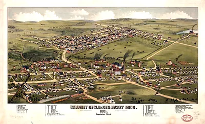
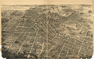
Benton Harbor, Michigan, 1889 – Historic Map Reproduction

(Originally scanned by the Library of Congress. Each image is professionally and digitally cleaned of artifacts such as color bars and extra borders prior to printing.)
Description
Benton Harbor, Michigan, 1889 comes to life in this antique map, reproduced from the original with every detail intact. It comes from the collections of the Library of Congress, scanned from the original and carefully restored.
Library of Congress record: Benton Harbor, Mich. 1889
Framed, it is ready for the wall; unframed, it is ready for the frame you choose. A conversation-starting piece for home, office, or as a meaningful gift. Free shipping in the lower 48 states. Snapshots of the Past has been bringing history to the wall since 2001, for tens of thousands of customers worldwide.
Benton Harbor, Michigan, 1889
Order a print
Thank you. Your order went through, and a receipt is on its way by email.
Secure checkout · SSL encryptedPowered by Stripe and PayPal
Free shipping in the lower 48 states. The checkout page shows the picture, size and price before you pay.
Benton Harbor, Michigan, in 1889 sat on the river a short distance from Lake Michigan, and its fortunes rested largely on fruit. Peach and grape orchards spread across the sandy ground around the town, and growers shipped their crops by rail and by lake steamer to Chicago and other markets. The river harbor gave local vessels access to the lake, while the fruit trade drew seasonal labor and capital into the community. Across the water, St. Joseph served as a neighboring port, and the two towns shared commerce and a growing summer population drawn to the nearby shore. A view from that year would have shown a place still defined by its orchards, warehouses, and the river that carried its produce outward.
| Created / published | 1889 |
|---|---|
| Creator | c.j. pauli & co |
| Notes | Bird's-eye view map. |
| Subjects | Panoramic maps--Michigan |
| Source | Library of Congress, Panoramic Maps |
| Original scan | 8,992 × 6,912 px · prints to 30 × 23 in at 300 dpi |
| Library of Congress title | Benton Harbor, Mich. 1889 |
| Reference | MI-BentonHarbor-1889 |
More from the Panoramic Maps collection
Snapshots of the Past helps heritage brands, museums, historians and storytellers tell stories with history: historic prints, image licensing and historical storytelling drawn from more than 25 years of research and curation.