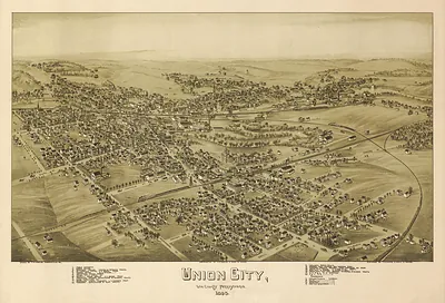
View of the City of Franklin, Pa. 1901 – Antique Wall Map

(Originally scanned by the Library of Congress. Each image is professionally and digitally cleaned of artifacts such as color bars and extra borders prior to printing.)
Description
This antique map of View of the City of Franklin, Pa. 1901 brings a moment of history to your wall. It comes from the collections of the Library of Congress, scanned from the original and carefully restored.
Library of Congress record: View of the city of Franklin, Pa., 1901
The framed print arrives ready to hang; the unframed option suits custom framing. A conversation-starting piece for home, office, or as a meaningful gift. Free shipping in the lower 48 states. Snapshots of the Past has been bringing history to the wall since 2001, for tens of thousands of customers worldwide.
View of the City of Franklin, Pa. 1901
Order a print
Thank you. Your order went through, and a receipt is on its way by email.
Secure checkout · SSL encryptedPowered by Stripe and PayPal
Free shipping in the lower 48 states. The checkout page shows the picture, size and price before you pay.
Franklin, the county seat of Venango County, sits where French Creek joins the Allegheny River, and this 1901 bird's-eye view shows that river-town setting from an elevated vantage point. James B. Moyer and T. M. Fowler, both known for city views of this kind, drew the panorama in a perspective style meant to help residents and visitors recognize streets, churches and factories at a glance. Franklin's growth owed much to the nearby oil fields of northwestern Pennsylvania, which brought wealth, rail lines and new industry to the valley. The waterways and rail corridors are worth tracing, since they explain why the town grew where it did.
| Created / published | 1901 |
|---|---|
| Creator | moyer, james b., fowler, t. m. (thaddeus mortimer) |
| Source | Library of Congress, Panoramic Maps |
| Original scan | 5,232 × 3,128 px · prints to 17 × 10 in at 300 dpi |
| Library of Congress title | View of the city of Franklin, Pa., 1901 |
| Reference | PA-Franklin-1901 |
More from the PAN MAPS collection
Snapshots of the Past helps heritage brands, museums, historians and storytellers tell stories with history: historic prints, image licensing and historical storytelling drawn from more than 25 years of research and curation.