[Map of the island of Hispaniola (Haiti & Dominican Republic)] – Vintage Map Wall Art

(Originally scanned by the Library of Congress. Each image is professionally and digitally cleaned of artifacts such as color bars and extra borders prior to printing.)
Description
This antique map of [Map of the island of Hispaniola (Haiti & Dominican Republic)] brings a moment of history to your wall. The original is held by the Library of Congress, so what you hang is a true record of its time.
Choose the framed print, ready to hang the day it arrives, or the unframed print for a frame of your own. It brings character to any room and makes a memorable gift. Free shipping in the lower 48 states. Since 2001, Snapshots of the Past has shipped historic prints to tens of thousands of customers around the world.
[Map of the island of Hispaniola (Haiti & Dominican Republic)]
Order a print
Thank you. Your order went through, and a receipt is on its way by email.
Secure checkout · SSL encryptedPowered by Stripe and PayPal
Free shipping in the lower 48 states. The checkout page shows the picture, size and price before you pay.
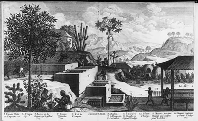
This engraved map of Hispaniola appeared as a plate in Jean Labat's *Nouveau Voyage*, published in The Hague in 1724, facing page 199 of the second volume. Labat, a French Dominican missionary, spent years in the Caribbean, and his travel accounts were widely read in Europe. The island he mapped was divided between Spain and France in the colonial era. The western third became the French colony of Saint-Domingue, which is now Haiti, while the eastern part is today the Dominican Republic.
| Created / published | 1724 |
|---|---|
| Medium | 1 print : engraving. |
| Subjects | Illus. in: Jean Labat, Nouveau Voyage ... La Haye, 1724, v. 2, oppos. p. 199. Reference copy may be in SSF (Gr) - MAPS--HISPANOLIA--1724. This record contains unverified, old data from caption card. Caption card tracings: Geogr.; Maps. |
| Source | Library of Congress, Prints and Photographs Division |
| Original scan | 3,300 × 2,327 px · prints to 11 × 8 in at 300 dpi |
| Reference | AMZ-SOTP-HPA-145636 |
More from the Historic Print Archive collection
Snapshots of the Past helps heritage brands, museums, historians and storytellers tell stories with history: historic prints, image licensing and historical storytelling drawn from more than 25 years of research and curation.