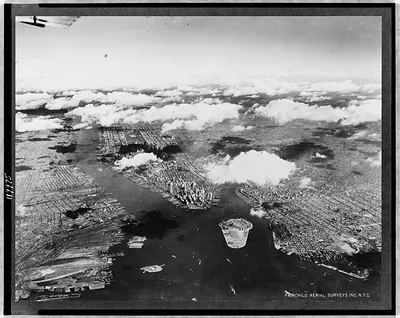
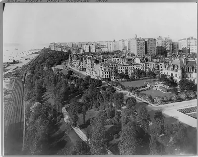
Aerial view of Riverside Drive and Henry Hudson Parkway in New York / Fairchild Aerial Surveys, Inc. – Vintage Wall Art

(Originally scanned by the Library of Congress. Each image is professionally and digitally cleaned of artifacts such as color bars and extra borders prior to printing.)
Description
This historic photograph of Aerial view of Riverside Drive and Henry Hudson Parkway in New York / Fairchild Aerial Surveys, Inc. brings a moment of history to your wall. It comes from the collections of the Library of Congress, scanned from the original and carefully restored.
Framed, it is ready for the wall; unframed, it is ready for the frame you choose. A fine choice for anyone who loves history, and a gift that gets noticed. Free shipping in the lower 48 states. Snapshots of the Past, founded in 2001, has served tens of thousands of customers worldwide.
Aerial view of Riverside Drive and Henry Hudson Parkway in New York / Fairchild Aerial Surveys, Inc.
Order a print
Thank you. Your order went through, and a receipt is on its way by email.
Secure checkout · SSL encryptedPowered by Stripe and PayPal
Free shipping in the lower 48 states. The checkout page shows the picture, size and price before you pay.
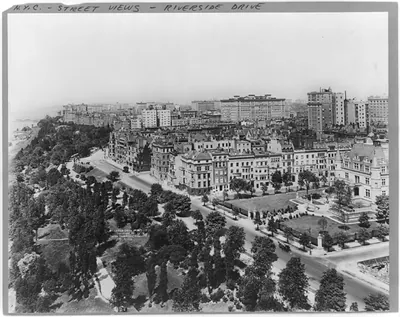
Few views show the Hudson shoreline on Manhattan's West Side as clearly as this aerial survey, which captures the Henry Hudson Parkway hugging the river beside Riverside Drive, the tree-lined boulevard that runs along the bluff above it. The parkway, a limited-access road built in the late 1930s, was part of a wave of New York highways designed to move cars quickly along the city's edges. Fairchild Aerial Surveys, a leading mapping firm of the period, made the photograph from the air, and its overhead angle shows how the road, the park and the river fit together as one corridor.
| Created / published | [between 1937 and 1946] |
|---|---|
| Medium | 1 photographic print. |
| Genre | Aerial photographs 1930-1950.Photographic prints 1930-1950. |
| Notes | Farm Security Administration and Office of War Information Collection (Library of Congress). Office for Emergency Management. No. 41-2765. |
| Subjects | Express highways--New York (State)--New York--1930-1950. Streets--New York (State)--New York--1930-1950. |
| Source | Library of Congress, Prints and Photographs Division |
| Original scan | 3,273 × 4,096 px · prints to 11 × 14 in at 300 dpi |
| Reference | AMZ-SOTP-HPA-195045 |
More from the New York City collection
Snapshots of the Past helps heritage brands, museums, historians and storytellers tell stories with history: historic prints, image licensing and historical storytelling drawn from more than 25 years of research and curation.