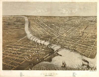
Portage, Wisconsin, 1868 – Vintage Map Wall Art

(Originally scanned by the Library of Congress. Each image is professionally and digitally cleaned of artifacts such as color bars and extra borders prior to printing.)
Description
A window into the past: Portage, Wisconsin, 1868, preserved in this antique map. An authentic image from the Library of Congress, it carries the weight of the real historical record.
Library of Congress record: Bird's eye view of the city of Portage, Columbia Co., Wisconsin 1868
The framed print arrives ready to hang; the unframed option suits custom framing. It makes a striking addition to a living room, study or office, and a thoughtful gift. Free shipping in the lower 48 states. Snapshots of the Past, founded in 2001, has served tens of thousands of customers worldwide.
Portage, Wisconsin, 1868
Order a print
Thank you. Your order went through, and a receipt is on its way by email.
Secure checkout · SSL encryptedPowered by Stripe and PayPal
Free shipping in the lower 48 states. The checkout page shows the picture, size and price before you pay.
Portage, Wisconsin, in 1868 was a small river town built on the narrow land carry between the Fox and Wisconsin rivers, a route that Native peoples, French traders, and voyageurs had used for generations before American settlers arrived. By the late 1860s its economy rested on the water: sawmills and lumber, grain and flour shipped downstream, and canal improvements that helped boats get past the portage. Fort Winnebago, established in the 1820s on the same ground, had long since given way to a civilian town of merchants, mill hands, and farmers from the surrounding countryside. The decade after the Civil War brought steady growth and new rail links to the region, and residents would have known Portage above all as the place where the two rivers nearly met.
| Created / published | 1868 |
|---|---|
| Creator | ruger, a., chicago lithographing co |
| Notes | Bird's-eye view map. |
| Subjects | Panoramic maps--Wisconsin |
| Source | Library of Congress, Panoramic Maps |
| Original scan | 8,912 × 6,864 px · prints to 30 × 23 in at 300 dpi |
| Library of Congress title | Bird's eye view of the city of Portage, Columbia Co., Wisconsin 1868 |
| Reference | WI-Portage-1868 |
More from the Panoramic Maps collection
Snapshots of the Past helps heritage brands, museums, historians and storytellers tell stories with history: historic prints, image licensing and historical storytelling drawn from more than 25 years of research and curation.