Colton's Virginia map, 1862 – Vintage Map Wall Art

(Each image is professionally and digitally cleaned of artifacts such as color bars and extra borders prior to printing.)
Description
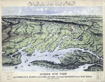
A window into the past: Colton's Virginia map, 1862, preserved in this antique map. Drawn from the Snapshots of the Past archive, it is an authentic piece of documented history.
Order it framed and ready to hang, or unframed to match a frame you already love. It brings character to any room and makes a memorable gift. Free shipping in the lower 48 states. Snapshots of the Past has been bringing history to the wall since 2001, for tens of thousands of customers worldwide.
Colton's Virginia map, 1862
Order a print
Thank you. Your order went through, and a receipt is on its way by email.
Secure checkout · SSL encryptedPowered by Stripe and PayPal
Free shipping in the lower 48 states. The checkout page shows the picture, size and price before you pay.
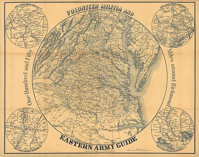
Colton's 1862 map of Virginia predates the Blue Ridge Parkway by several decades, yet it shows the same mountain country as a network of gaps, river valleys, and roads. The Colton firm was a well-known New York mapmaker, and this sheet appeared while the Civil War was being fought across Virginia, when armies moved through those passes and accurate road information carried real consequences. The Blue Ridge runs as a long spine from southwest to northeast, a line that later became a scenic route.
| Original scan | 3,600 × 3,012 px · prints to 12 × 10 in at 300 dpi |
|---|---|
| Reference | lva00093 colton's virginia |
More from the Blue Ridge Parkway collection
Snapshots of the Past helps heritage brands, museums, historians and storytellers tell stories with history: historic prints, image licensing and historical storytelling drawn from more than 25 years of research and curation.