A Plan Of The Town Of Boston And Its Environs, With The Lines, Batteries, And Incampments Of The British And American Armies – Historic Print

(Each image is professionally and digitally cleaned of artifacts such as color bars and extra borders prior to printing.)
Description
This historic image of A Plan Of The Town Of Boston And Its Environs, With The Lines, Batteries, And Incampments Of The British And American Armies brings a moment of history to your wall. Drawn from the Snapshots of the Past archive, it is an authentic piece of documented history.
Framed, it is ready for the wall; unframed, it is ready for the frame you choose. Perfect for a home, office, library or classroom wall, and a gift with a story behind it. Free shipping in the lower 48 states. Since 2001, Snapshots of the Past has shipped historic prints to tens of thousands of customers around the world.
A Plan Of The Town Of Boston And Its Environs, With The Lines, Batteries, And Incampments Of The British And American Armies
Order a print
Thank you. Your order went through, and a receipt is on its way by email.
Secure checkout · SSL encryptedPowered by Stripe and PayPal
Free shipping in the lower 48 states. The checkout page shows the picture, size and price before you pay.
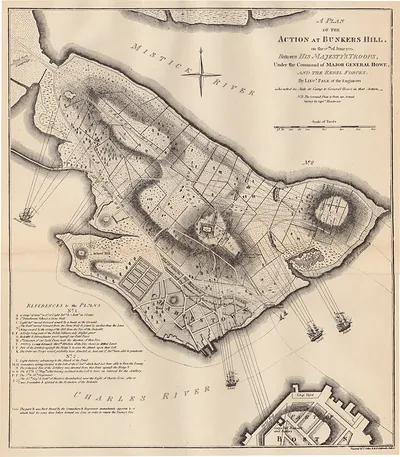
Few maps of the siege of Boston show both armies at once, but this manuscript plan records the lines, batteries, and encampments of the British and American forces side by side, along with hachured relief and soundings of the harbor. Sir Thomas Hyde Page, a British military engineer, drew it with pen and watercolor during the siege that began in 1775, when colonial troops ringed the town and the British held it by sea. The map shows how the fighting turned on the surrounding hills and water, and it helps explain the American move onto Dorchester Heights that led to the British evacuation in March 1776.
| Notes | Sir Thomas Hyde Page, 1746-1821. Manuscript, pen-and-ink and watercolor. Scale ca. 1:24,000. Relief shown by hachures. Depths shown by soundings |
|---|---|
| Original scan | 3,880 × 2,752 px · prints to 13 × 9 in at 300 dpi |
| Reference | MA Boston Town Plan 1775 |
More from the Washington collection
Snapshots of the Past helps heritage brands, museums, historians and storytellers tell stories with history: historic prints, image licensing and historical storytelling drawn from more than 25 years of research and curation.