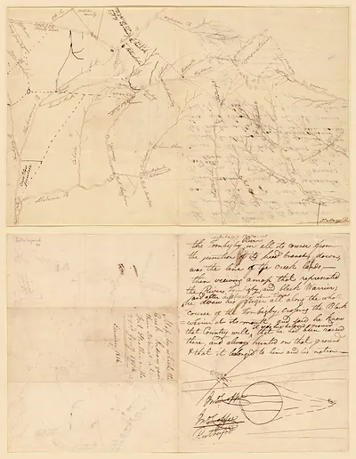
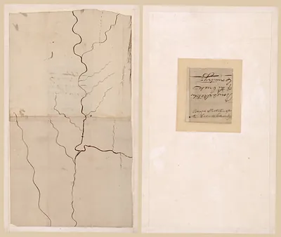
A Plan of part of the Rivers Tombecbe, Alabama, Tensaw, Perdido, Mobile – Antique Wall Art

(Each image is professionally and digitally cleaned of artifacts such as color bars and extra borders prior to printing.)
Description
A window into the past: A Plan of part of the Rivers Tombecbe, Alabama, Tensaw, Perdido, Mobile, preserved in this historic image. Drawn from the Snapshots of the Past archive, it is an authentic piece of documented history.
The framed print arrives ready to hang; the unframed option suits custom framing. It brings character to any room and makes a memorable gift. Free shipping in the lower 48 states. Since 2001, Snapshots of the Past has shipped historic prints to tens of thousands of customers around the world.
A Plan of part of the Rivers Tombecbe, Alabama, Tensaw, Perdido, Mobile
Order a print
Thank you. Your order went through, and a receipt is on its way by email.
Secure checkout · SSL encryptedPowered by Stripe and PayPal
Free shipping in the lower 48 states. The checkout page shows the picture, size and price before you pay.
This plan charts a low, watery stretch of the Gulf Coast where the Tombigbee, Alabama, Tensaw, Perdido, and Mobile rivers meet in a tangle of channels and bayous. Its focus is the delta country of southwestern Alabama, far from the Tallapoosa bend where the battle of 1814 took place. That region passed among Spain, France, Britain, and the United States during the eighteenth and early nineteenth centuries, and the Tensaw settlements were the site of Fort Mims, attacked by Red Stick Creeks in 1813, which helped set off the Creek War. Maps like this one show how the river network shaped travel, trade, and military movement in the Old Southwest.
| Original scan | 1,501 × 1,321 px · prints to 5 × 4 in at 300 dpi |
|---|---|
| Reference | ar164900 A plan of part of the rivers Tombecbe, Alabama, |
More from the Horseshoe Bend National Military Park collection
Snapshots of the Past helps heritage brands, museums, historians and storytellers tell stories with history: historic prints, image licensing and historical storytelling drawn from more than 25 years of research and curation.