Boston July 4, Massachusetts, 1870 – Vintage Map Wall Art

(Originally scanned by the Library of Congress. Each image is professionally and digitally cleaned of artifacts such as color bars and extra borders prior to printing.)
Description
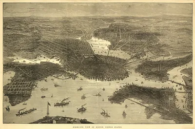
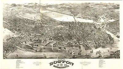
This antique map of Boston July 4, Massachusetts, 1870 brings a moment of history to your wall. The original is held by the Library of Congress, so what you hang is a true record of its time.
Library of Congress record: View of Boston, July 4th 1870
The framed print arrives ready to hang; the unframed option suits custom framing. It makes a striking addition to a living room, study or office, and a thoughtful gift. Free shipping in the lower 48 states. Snapshots of the Past has been bringing history to the wall since 2001, for tens of thousands of customers worldwide.
Boston July 4, Massachusetts, 1870
Order a print
Thank you. Your order went through, and a receipt is on its way by email.
Secure checkout · SSL encryptedPowered by Stripe and PayPal
Free shipping in the lower 48 states. The checkout page shows the picture, size and price before you pay.
Boston in 1870 was a city of roughly 250,000 people, crowded onto a peninsula that was still being reshaped as the Back Bay was filled with gravel and new streets were laid over former tidal flats. The city's economy rested on its harbor, on wholesale trade, and on factories and workshops producing shoes, clothing, and leather goods, while railroads radiating from the city carried freight and passengers to and from New England and beyond. Irish immigrants made up a large and growing share of the population, and their neighborhoods in the North End and South Boston were increasingly shaping local politics. The sheet's title, with its July 4 date, points to Independence Day, which Bostonians marked with parades, bell ringing, and speeches on the Common and near Faneuil Hall.
| Created / published | 1870 |
|---|---|
| Creator | weik, john, fuchs, f., new england lithographic co |
| Notes | Bird's-eye view map. |
| Subjects | Panoramic maps--Massachusetts |
| Source | Library of Congress, Panoramic Maps |
| Original scan | 5,688 × 4,344 px · prints to 19 × 14 in at 300 dpi |
| Library of Congress title | View of Boston, July 4th 1870 |
| Reference | MA-BostonJuly4-1870 |
More from the Panoramic Maps collection
Snapshots of the Past helps heritage brands, museums, historians and storytellers tell stories with history: historic prints, image licensing and historical storytelling drawn from more than 25 years of research and curation.