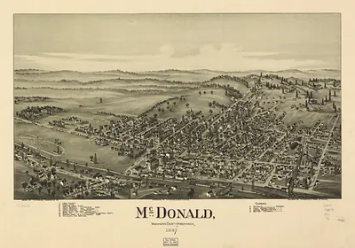
Wilmerding, Pennsylvania, 1897 – Antique Wall Map

(Originally scanned by the Library of Congress. Each image is professionally and digitally cleaned of artifacts such as color bars and extra borders prior to printing.)
Description
A window into the past: Wilmerding, Pennsylvania, 1897, preserved in this antique map. The original is held by the Library of Congress, so what you hang is a true record of its time.
Library of Congress record: Wilmerding, Allegheny County, Pennsylvania 1897
Framed, it is ready for the wall; unframed, it is ready for the frame you choose. It makes a striking addition to a living room, study or office, and a thoughtful gift. Free shipping in the lower 48 states. Snapshots of the Past, founded in 2001, has served tens of thousands of customers worldwide.
Wilmerding, Pennsylvania, 1897
Order a print
Thank you. Your order went through, and a receipt is on its way by email.
Secure checkout · SSL encryptedPowered by Stripe and PayPal
Free shipping in the lower 48 states. The checkout page shows the picture, size and price before you pay.
Wilmerding, Pennsylvania, in 1897 was a young company town in the Turtle Creek valley east of Pittsburgh. George Westinghouse's Westinghouse Air Brake Company had built its main works there, and the air brakes it made were becoming standard equipment on American railroads as trains grew longer and heavier. Most residents worked in the shops or depended on those wages, so the streets and houses were arranged around factory shifts and the rail lines that brought in materials and carried finished brakes away. The Pittsburgh district was then a major center of iron, steel, and railroad manufacturing, and Wilmerding's identity was tied closely to that industrial world.
| Created / published | 1897 |
|---|---|
| Creator | moyer, james b., fowler, t. m. (thaddeus mortimer) |
| Notes | Bird's-eye view map. |
| Subjects | Panoramic maps--Pennsylvania |
| Source | Library of Congress, Panoramic Maps |
| Original scan | 7,640 × 5,552 px · prints to 25 × 19 in at 300 dpi |
| Library of Congress title | Wilmerding, Allegheny County, Pennsylvania 1897 |
| Reference | PA-Wilmerding-1897 |
More from the Panoramic Maps collection
Snapshots of the Past helps heritage brands, museums, historians and storytellers tell stories with history: historic prints, image licensing and historical storytelling drawn from more than 25 years of research and curation.