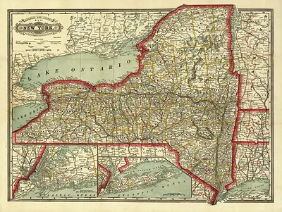
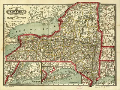
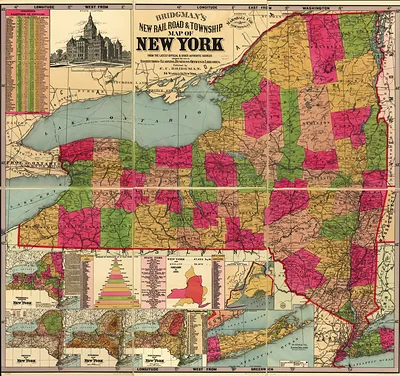
NY State Tunisons railroad, distance, and township map of New York from latest surveys – Antique Wall Map

(Each image is professionally and digitally cleaned of artifacts such as color bars and extra borders prior to printing.)
Description
Step back in time with NY State Tunisons railroad, distance, and township map of New York from latest surveys, an antique map rich in period detail. Drawn from the Snapshots of the Past archive, it is an authentic piece of documented history.
Order it framed and ready to hang, or unframed to match a frame you already love. It brings character to any room and makes a memorable gift. Free shipping in the lower 48 states. Since 2001, Snapshots of the Past has shipped historic prints to tens of thousands of customers around the world.
NY State Tunisons railroad, distance, and township map of New York from latest surveys
Order a print
Thank you. Your order went through, and a receipt is on its way by email.
Secure checkout · SSL encryptedPowered by Stripe and PayPal
Free shipping in the lower 48 states. The checkout page shows the picture, size and price before you pay.
Rather than a single town or depot, this 1898 map covers all of New York State, tracing railroad lines across the township boundaries that organized the countryside. Maps of this kind, issued under the Tunison name, helped travelers, shippers and land agents see how far one station lay from another and which line served a given community. By the late 1890s New York had one of the densest rail networks in the country, and a sheet that put distances and townships together shows how closely the railroads had come to shaping daily travel and commerce. Notice how the lines converge on the state's major cities.
| Created / published | 1898 |
|---|---|
| Original scan | 3,000 × 3,771 px · prints to 10 × 13 in at 300 dpi |
| Reference | NY State Tunisons railroad, distance, and township map of New York from latest surveys 1898 |
More from the Railroads & Depots collection
Snapshots of the Past helps heritage brands, museums, historians and storytellers tell stories with history: historic prints, image licensing and historical storytelling drawn from more than 25 years of research and curation.