Portland, Oregon, 1880 – Historic Map Reproduction

(Each image is professionally and digitally cleaned of artifacts such as color bars and extra borders prior to printing.)
Description
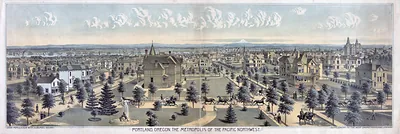
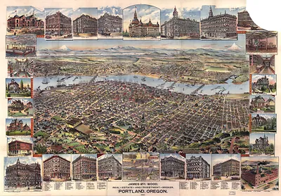
Few images capture their era like this antique map of Portland, Oregon, 1880. It comes from the Snapshots of the Past collection, curated over 25 years for its historical value.
Framed, it is ready for the wall; unframed, it is ready for the frame you choose. A fine choice for anyone who loves history, and a gift that gets noticed. Free shipping in the lower 48 states. Snapshots of the Past has been bringing history to the wall since 2001, for tens of thousands of customers worldwide.
Portland, Oregon, 1880
Order a print
Thank you. Your order went through, and a receipt is on its way by email.
Secure checkout · SSL encryptedPowered by Stripe and PayPal
Free shipping in the lower 48 states. The checkout page shows the picture, size and price before you pay.
Portland in 1880 was a river city of wharves, sawmills, and grain warehouses, and its growth depended on the Willamette and Columbia rivers as much as on its streets. Henry Villard's railroad and steamboat interests were consolidating transport across the Columbia basin in these years, which kept Portland's merchants watching freight rates and steamer schedules closely. Lumber mills along the Willamette shipped boards and timber to California, Asia, and Pacific ports, while wheat from the interior valleys moved down river for export. The city's Chinese community, concentrated in a district near the older downtown blocks, worked in many of the same trades and drew hostile comment from white labor organizers, a tension that shaped local politics through the decade.
| Created / published | 1880 |
|---|---|
| Notes | Bird's-eye view map. |
| Subjects | Panoramic maps--Oregon |
| Original scan | 12,041 × 7,516 px · prints to 40 × 25 in at 300 dpi |
| Reference | OR-Portland-1880 |
More from the Panoramic Maps collection
Snapshots of the Past helps heritage brands, museums, historians and storytellers tell stories with history: historic prints, image licensing and historical storytelling drawn from more than 25 years of research and curation.