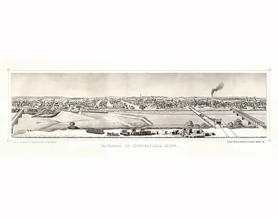
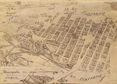
Minneapolis Saint Anthony, Minnesota – Antique Map Print

(Originally scanned by the Library of Congress. Each image is professionally and digitally cleaned of artifacts such as color bars and extra borders prior to printing.)
Description
This antique map of Minneapolis Saint Anthony, Minnesota brings a moment of history to your wall. It comes from the collections of the Library of Congress, scanned from the original and carefully restored.
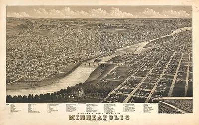
Library of Congress record: Minneapolis and Saint Anthony, Minnesota 1867
Choose the framed print, ready to hang the day it arrives, or the unframed print for a frame of your own. A fine choice for anyone who loves history, and a gift that gets noticed. Free shipping in the lower 48 states. Snapshots of the Past, founded in 2001, has served tens of thousands of customers worldwide.
Minneapolis Saint Anthony, Minnesota
Order a print
Thank you. Your order went through, and a receipt is on its way by email.
Secure checkout · SSL encryptedPowered by Stripe and PayPal
Free shipping in the lower 48 states. The checkout page shows the picture, size and price before you pay.
Minneapolis and Saint Anthony, the twin milling cities on either side of the Mississippi Falls, stood at the center of Minnesota's lumber and flour trade in 1867. Sawmills along the river turned pine floated down from the north into boards and shingles, while the falls powered grain mills that were making Minnesota flour known well beyond the state. The Saint Anthony Falls water power had drawn settlers since the 1850s, and both towns were growing quickly as railroads pushed west and east toward them. Saint Anthony still held its own separate charter, and the two communities would not combine into one city until 1872, so residents in 1867 would have thought of them as neighboring rivals as much as a single place.
| Created / published | 1867 |
|---|---|
| Creator | ruger, a., chicago lithographing co |
| Notes | Bird's-eye view map. |
| Subjects | Panoramic maps--Minnesota |
| Source | Library of Congress, Panoramic Maps |
| Original scan | 4,512 × 3,432 px · prints to 15 × 11 in at 300 dpi |
| Library of Congress title | Minneapolis and Saint Anthony, Minnesota 1867 |
| Reference | MN-MinneapolisSaintAnthony |
More from the Panoramic Maps collection
Snapshots of the Past helps heritage brands, museums, historians and storytellers tell stories with history: historic prints, image licensing and historical storytelling drawn from more than 25 years of research and curation.